|
        |
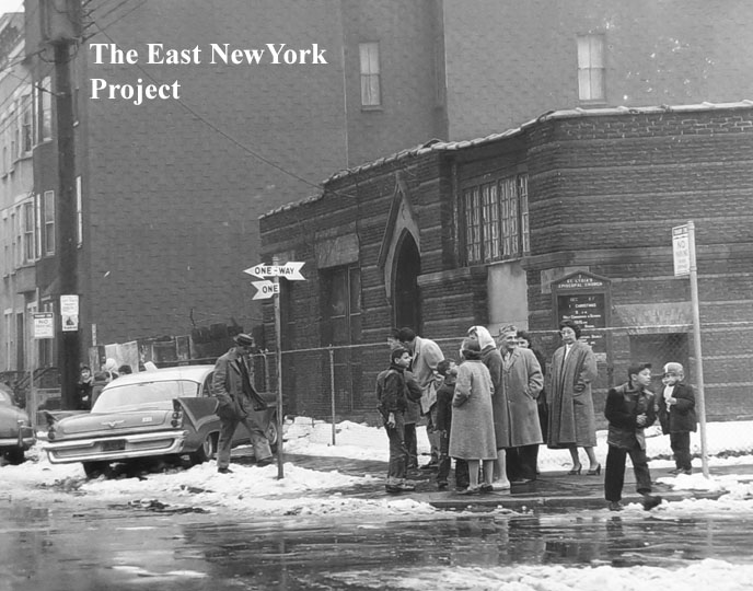
Zone 6South of Atlantic, East of Elton St.
|
|||
| Elton and Linwood Streets have their own page, click here | |||
| Essex Street has its own page, click here | |||
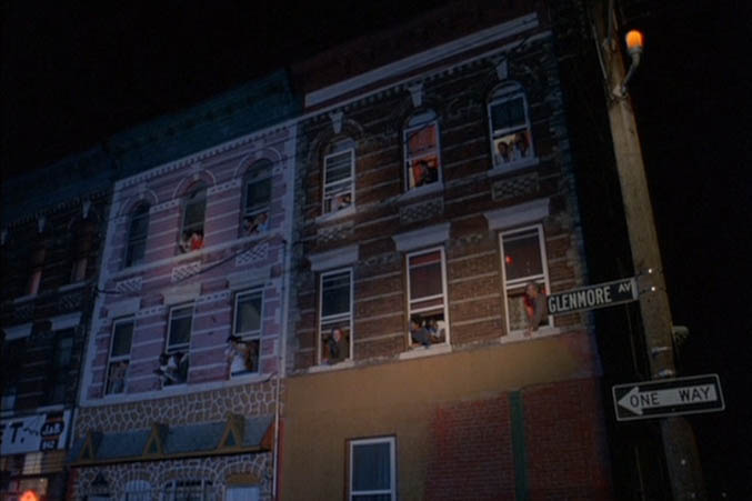
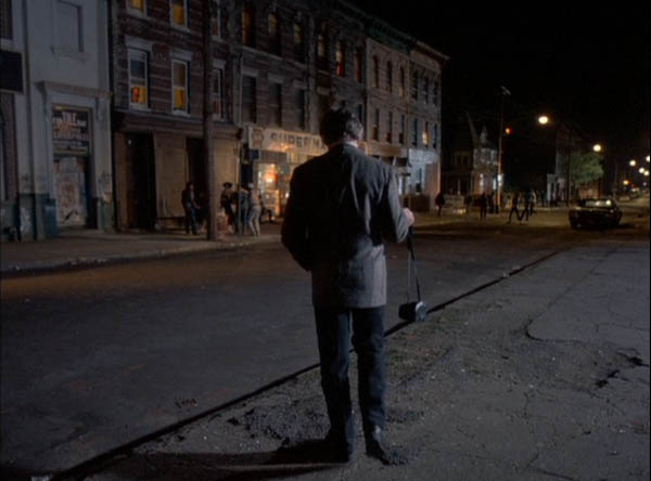
| Shepherd Avenue, south of Atlantic | |||
 |
 |
Two 1955 shots from Tony Della Croce that feature Shepherd Avenue. The first is of Father Vincent LaRocca, looking south down Shepherd. Tony speculates this was probably during the feast as the stanchions holding the banners are visible in the background. In the second shot Sister Mary Joannene is signing an autograph book on graduation day in front of the school yard. |
|
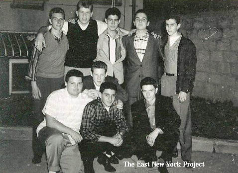 |
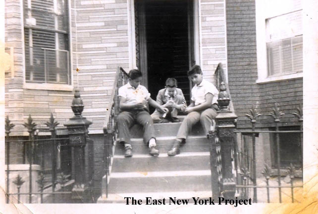
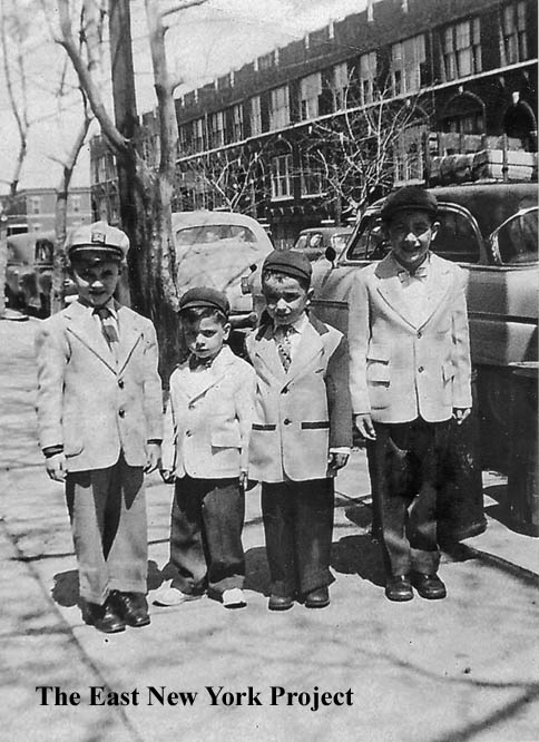
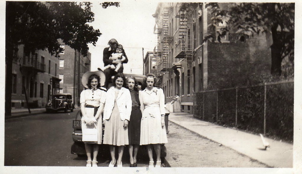
Also from Tony; "This picture is inscribed "Joe Aliberti's Backyard - July 1955". Joe lived on Shepherd Avenue (Between Atlantic and Liberty Avenues). The guys pictured are as follows: Top Row: Bob Gregas, John Abbracciamento, Marcy Gironta, Anthony DeSivio, Unknown Bottom Row: Joe Aliberti, Unknown, Bill Deliberti, Greg Giammalvo John Abbracciamento is the son of Sal Abbracciamento who owned Sal's Italian Restaurant on Liberty Avenue. Bill Deliberti is the son of Willie Deliberti who owned the Pastry Shop and Italian Ice Stand on Atlantic Avenue." |
||
 |
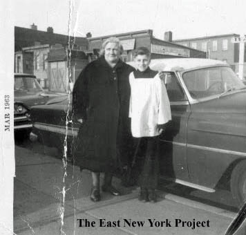 |
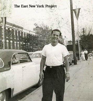
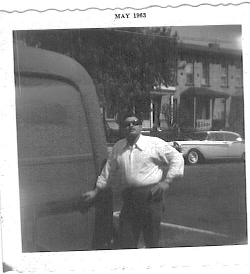
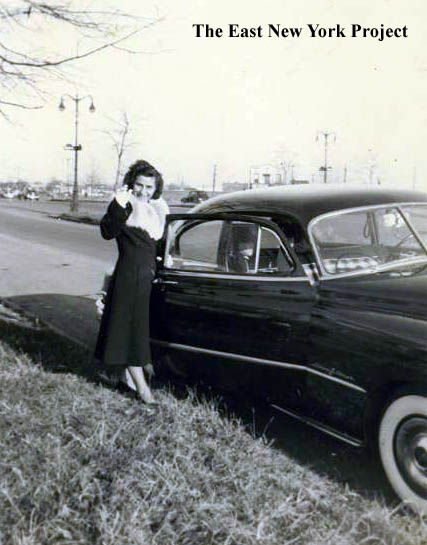
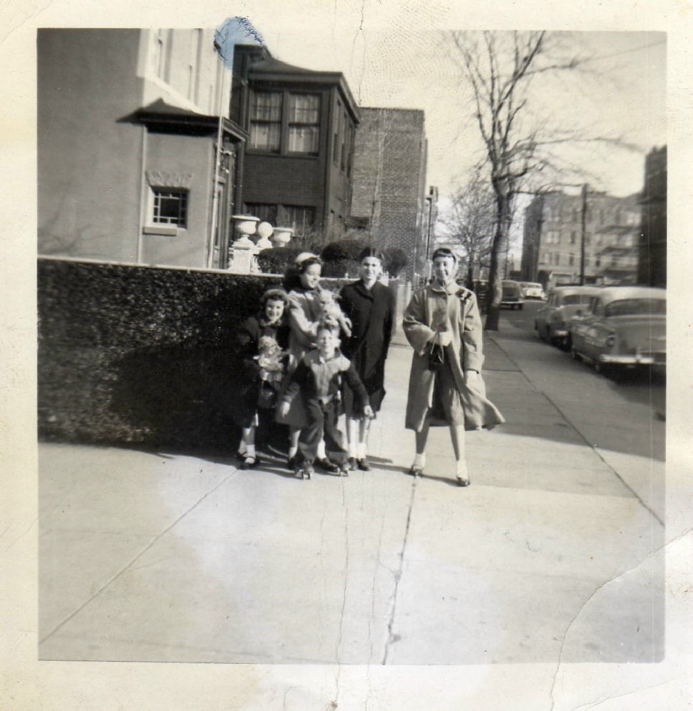
Veronica and Matt Shelfo sent over this 1952 pic of Frank Rose and Doris Shelfo standing in front of 389 Shepherd Ave. Across the way, Vinny Capasso sends over a 1963 pic of him and his grandmother Margaret Competello-Iervolino in front of 366 Shepherd Ave. Vin also identifies his uncles' Chevy behind them, as well as his dad's '57 Dodge and a sign for Barney's auto yard in the background. | |
 |
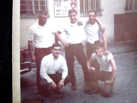 |
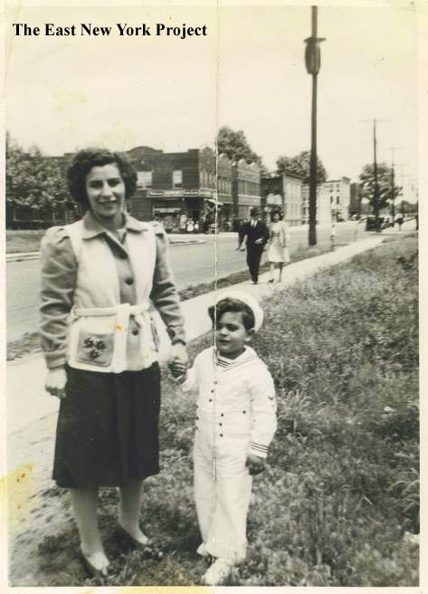
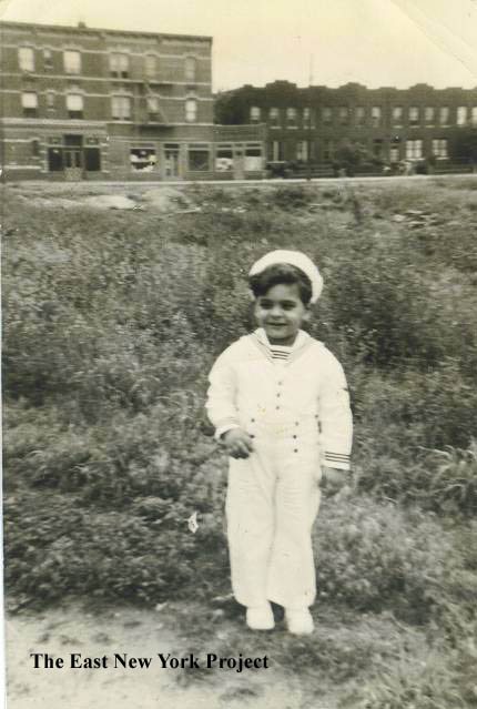
From Mike Biscuiti, a shot of Mike and his cousins Jack and Joe in front of 396 Shepherd. Great railing work in front of those houses with the awful fake brick shingle. On the right, Mike supplies of picture of him and ENY buddies in Germany. Mike explains; "The picture was taken during Labor Day weekend of 1967. The five of us had all joined or got drafted, and coincidentally ended up in various parts of Germany at the same time. My cousin Joe and I hopped in his car and spent the next two days traveling all over Germany picking up the others, then settled in Heidelberg for a celebration (it also happened to be the weekend of my 20th birthday). We had a great time, including walking along the Neckar River past the famous castle, singing the songs from West Side Story. There was even a small article about this reunion in the local Woodhaven newspaper soon afterwards." Pictured: (CW from upper left) is Tom Ruvolo (Norwood Ave), Charlie Passantino (Essex St), Joe Lombardi (Ashford St), yours truly - Mike Biscuiti (Shepherd Ave), and Chet Vinci (Linwood St). | |
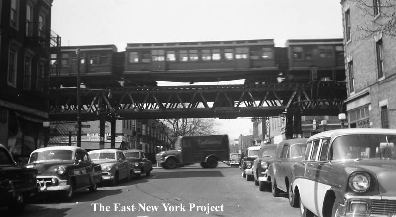 |
Shepherd Avenue, looking north to Pitkin, 1950 The old el is still standing in the shot, and a toy store on the northwest corner is visible across Pitkin. |
||
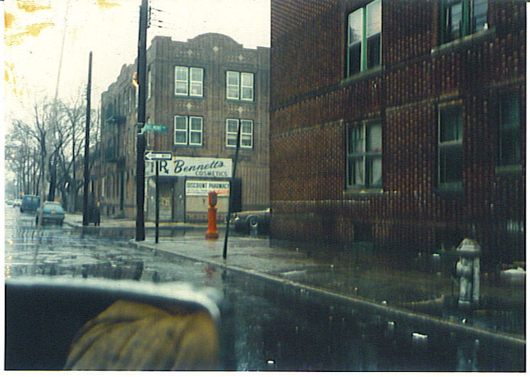 |
Rod Maggio sent in a series of photos from 1982. Bennett's Pharmacy sat on the southwest corner of Shepherd and Belmont. Rod recalls the store was sold to Artie Meltzer, who started as a stockboy and wound up owning 4 or 5 stores in the area. | ||
| Berriman Street and Atkins Avenue | |||
 |
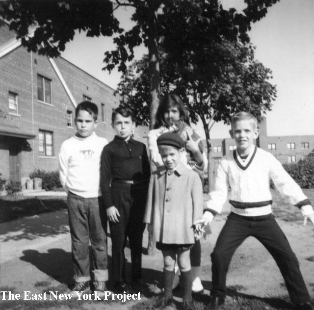 |
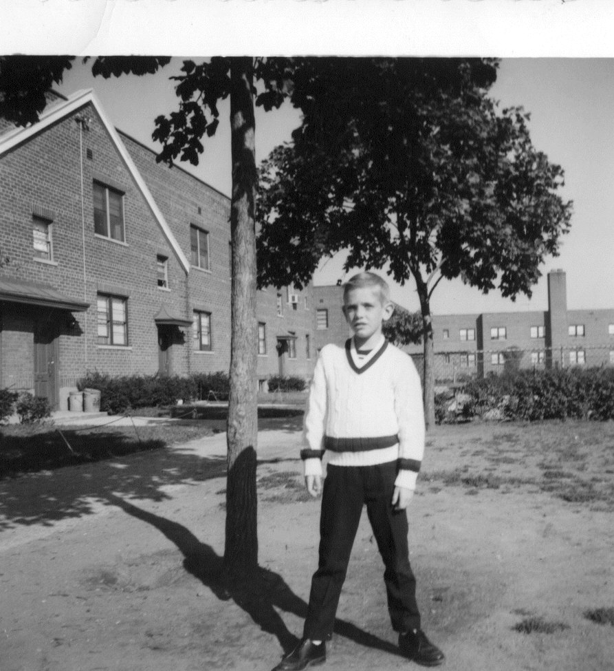
Arlington Village In the lower part of the 1st aerial image is an empty lot which was once a rail yard. A post war development called Arlington Village was built around 1948. Tony Davenport sent in these shots circa 1965. Tony recalls there were two developments; one by Berriman Street and one by Montauk. The Berriman one seemed to have all the kids, Tony recalled, though we are unsure if that was by design or not. That's Tony on the left and on the right ".. is Eddie (Gudebski), Keith Testa, Keith's sister Denise and me. That's my brother Jack in front." Tony also found his parents' 3-year lease from 1963-1966; the rent was $145 a month. . |
|
 |
 |
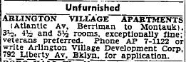
Arlington Village I found this 1948 ad for the Village which confirms our thoughts that the housing was intended for returning vets. On the right a 1970 photo sent by Tony Davenport with pal Michael Ray on confirmation day. Tony recalls "The village was a self-contained neighborhood in some ways. We had a Key Food attached on Liberty Ave, a luncheonette on Liberty. The apartments faced into an enclosed courtyard. Stickball, punch, hockey and skelsie, they were on the street. Football and baseball (we used a spongeball or hardball) were inside the courtyard. I'm told there were even swings and see-saws there, but they were down when I moved in in 63." |
|
 |
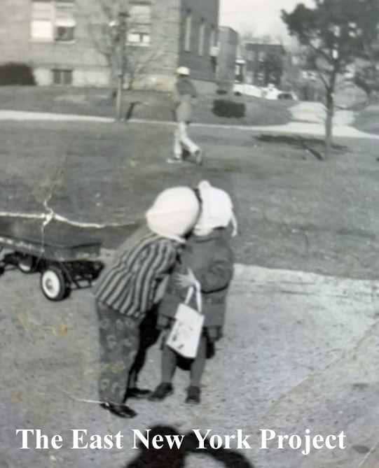 |
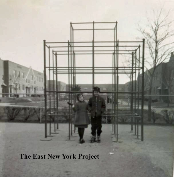
Arlington Village, ca. 1958 Jon Messer shared these views, circa 1958. He is with a friend Harriet Hirsch near the monkey bars in the image on the left. |
|
 |
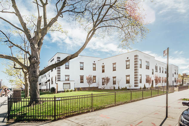 |
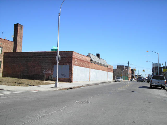
Arlington Village, 2006, 2018 Arlington Village was mostly boarded up and in a desperate state by the time Neil Sullivan sent over some photos in 2006. The shuttered building was the Key Food Supermarket. By 2018, the entire complex was renovated. |
|
 |
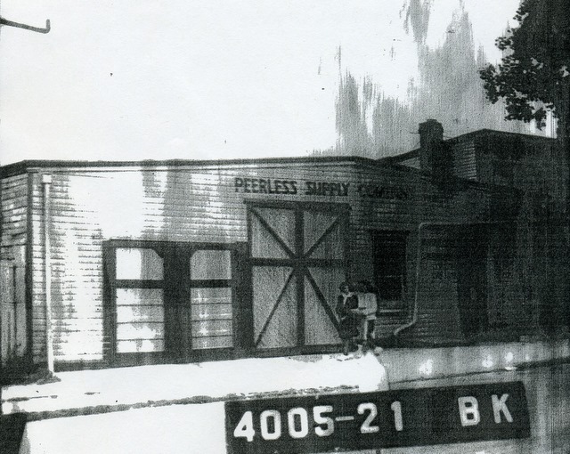 |
Rod Maggio's 1963 shot of himself in front of 154 Berriman has us investigating the history of that location. By this time it had long been a warehouse, in 1963 for Peerless Plumbing Supplies and a toy distributor. That's the 1941 tax photo on the right. The owner, however, told Rod the site was used by Vita-fone studios to shoot early movies, including Fatty Arbuckle. We are researching that one. | |
 |
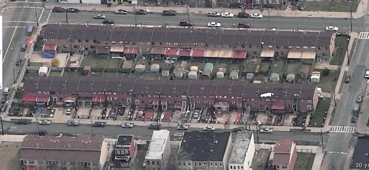 |
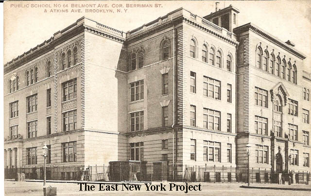
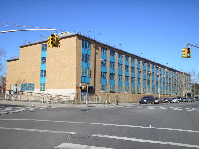
Public School 64, Belmont Ave. corner Berriman Maker: J. Shinske Dated: unk Status: Own(BG) Sitting between Berriman and Atkins on Belmont Ave. was P.S. 64. Even though this building was built in 1901, those who attended may be surprised to know it was not the first P.S. 64 in this location. We now have a page dedicated to P.S. 64 here. I don't have a date on closure or demolition; the housing development pictured on the right in this location was built in 1990. |
|
 |
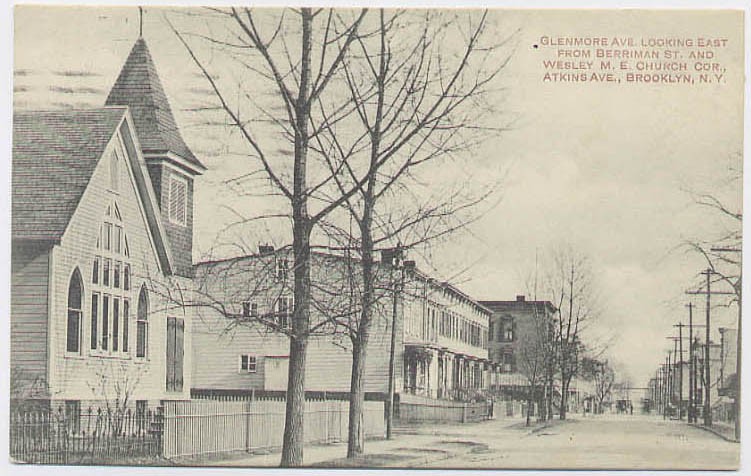 |
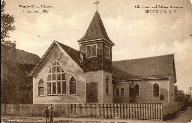
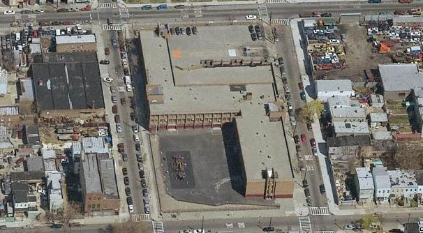
Wesley Methodist Episcopal Church, Glenmore and Atkins Maker: Wm. Fick Dated: Unk Status: Own (BG) Located on the north side of Glenmore, Wesley Methodist started as a mission in 1878, organized by a blacksmith in his shop. This structure was dedicated on Oct. 16, 1887 but not in this location- it was moved further west along Glenmore Avenue to this location in 1894. No longer standing, replaced by P.S. 345 in 1966. |
|
 |
 |
P.S. 345 The entire block was cleared for P.S. 345 in 1966. George Pizzo recalls his grandfather Guiseppe had a sweater factory on the same block - " My father recalled that my grandfather was friends with the pastor of Wesley Church whom was from Italy and (it) was very unusual at that time for an Italian being Protestant."On the right is a view of the northeast corner taken in 1940- those frame houses, visible in the old postcard above, are still standing. |
|
 |
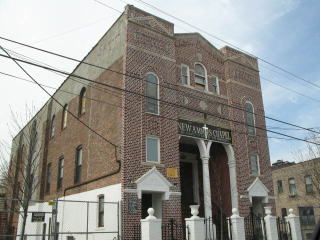 |
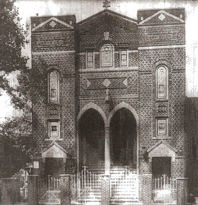
Temple Anshei Zedek Temple Anshai Zedek (Men of Righteousness) was located at 308 Atkins Avenue between Sutter and Blake. The congregation was founded in 1907, and this building was consecrated in 1919 (Levitt) It became the New Ammie's Chapel in 1970. The 1941 tax image gives some idea of how it looked as a synagogue. Thanks to Demetrius Pestun for the update photo. |
|
 |
 |
Moving further south down Atkins Avenue, David Goldstein sent these photos awhile back. The shots are looking north up Atkins Avenue in 1953, towards New Lots Avenue. That's David on the left and Sophie Hochstein on the right. | |
 |
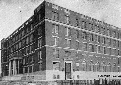 |
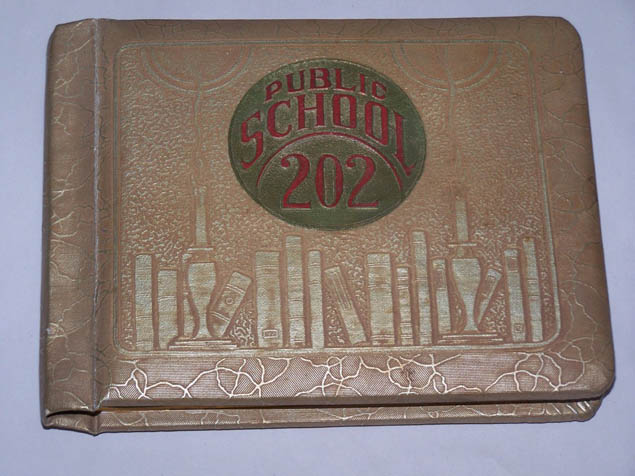
P.S. 202 We haven't heard from many folks who attended 202. We do know it was the school used by the Pride of Judea Orphan Home children. The school was opened in 1925 on the south side of Hegemann Avenue between Berriman Street and Atkins Avenue. |
|
| Montauk Avenue | |||
 |
 |
850 Glenmore Avenue, 1940s Jon Messer sent these images of 850 Glenmore Avenue, between Atkins and Montauk. The first is of his mother Rena with her brother, Jon's Uncle Stan. The image on the right was taken in the backyard; Jon's grandmother Mary is with his great-grandfather, Sam Tepfer, in 1941. Although 850 Glenmore was a woodframe home, it remains standing today. |
|
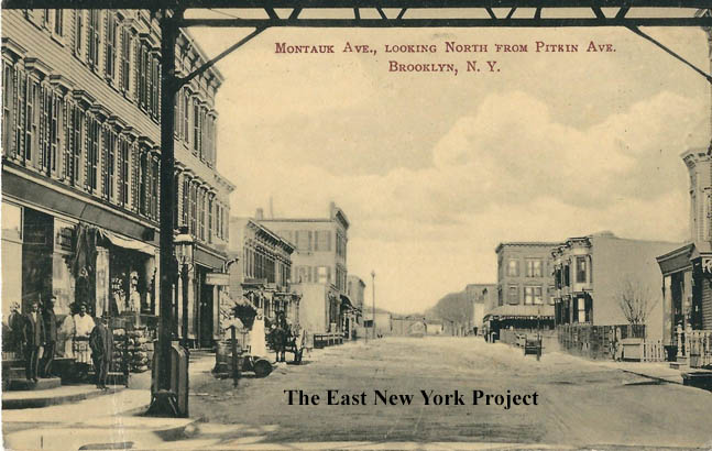 |
Montauk, North of Pitkin Ave. Maker: J. Shinske Dated: 1909 Status: Own(RG) Great rare Shinske card with a view up Montauk Avenue in 1909. |
||
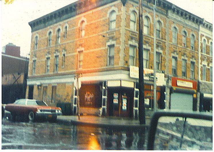 |
Rod Maggio sent in a series of photos from 1982. On the left, the corner of Montauk and Pitkin was the location for Brandt's Ice Cream Parlor. | ||
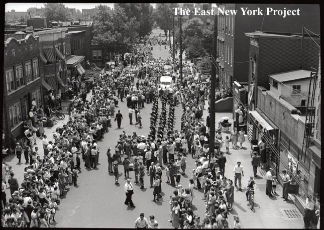 |
In 1942 a photographer captured a parade, with some shots taken from the Montauk Avenue station of the elevated line on Pitkin Avenue, looking south. To view the entire collection of photos click here.. | ||
 |
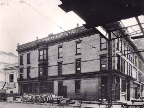 |
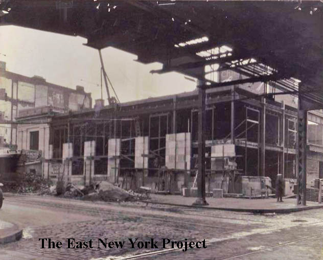
Montauk Bank Tom Hammond identified the location as the northeast corner of Pitkin and Montauk. Though he has a friend who recalls it was still a bank in later years, the building is no longer standing. From the Brian Merlis collection, Montauk Bank had headquarters elsewhere in Brooklyn and it may be just an extraordinary coincidence that they built a branch on Montauk Avenue itself. The construction takes place in 1927. It appears to be that there is already a banking structure on the far left, and large building to the right was meant to be offices, I don't know. . It became a branch of the Public National Bank in 1929, which was eventually acquired by Bankers Trust. The el along Pitkin is of course gone. |
|
 |
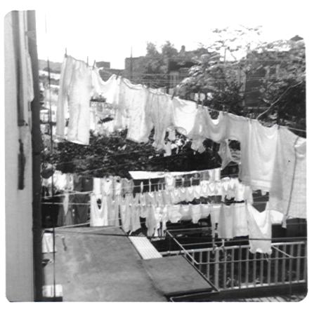 |
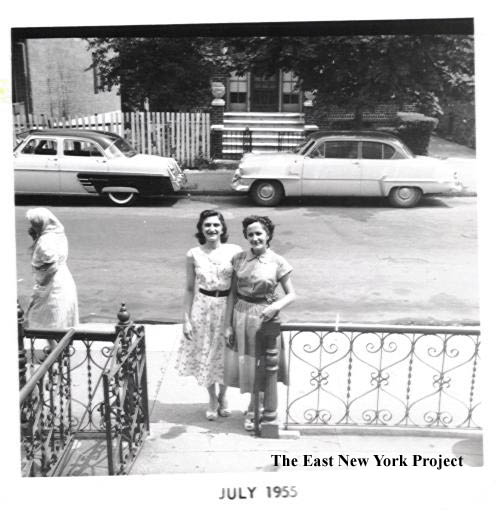
360 Montauk Avenue From Mike Bivona; "Sisters Mae Bivona Curti and Anne Bivona Ambrico in front of 360 Montauk Ave between Blake and Dumont Avenues, July 1955". On the right , "Wash Day" circa 1960. The question is, why did someone take this picture? |
|
 |
 |
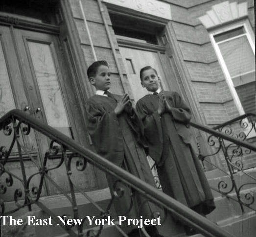
360 Montauk Avenue Marge Bivona supplied two pictures of 360 Montauk from the front. It's confirmation day, 1959. Lou Ambico and Joe Bivona are posing on the left and on the right Victor Bivona and son Joe in front of the house. |
|
 |
Montauk Avenue Also from Marge, this 1959 shot of Montauk Avenue fetaures her mother Rose, Uncle Mike Bivona and Aunt Ann Ambrico. |
||
| Logan Street has its own page, click here | |||
 |
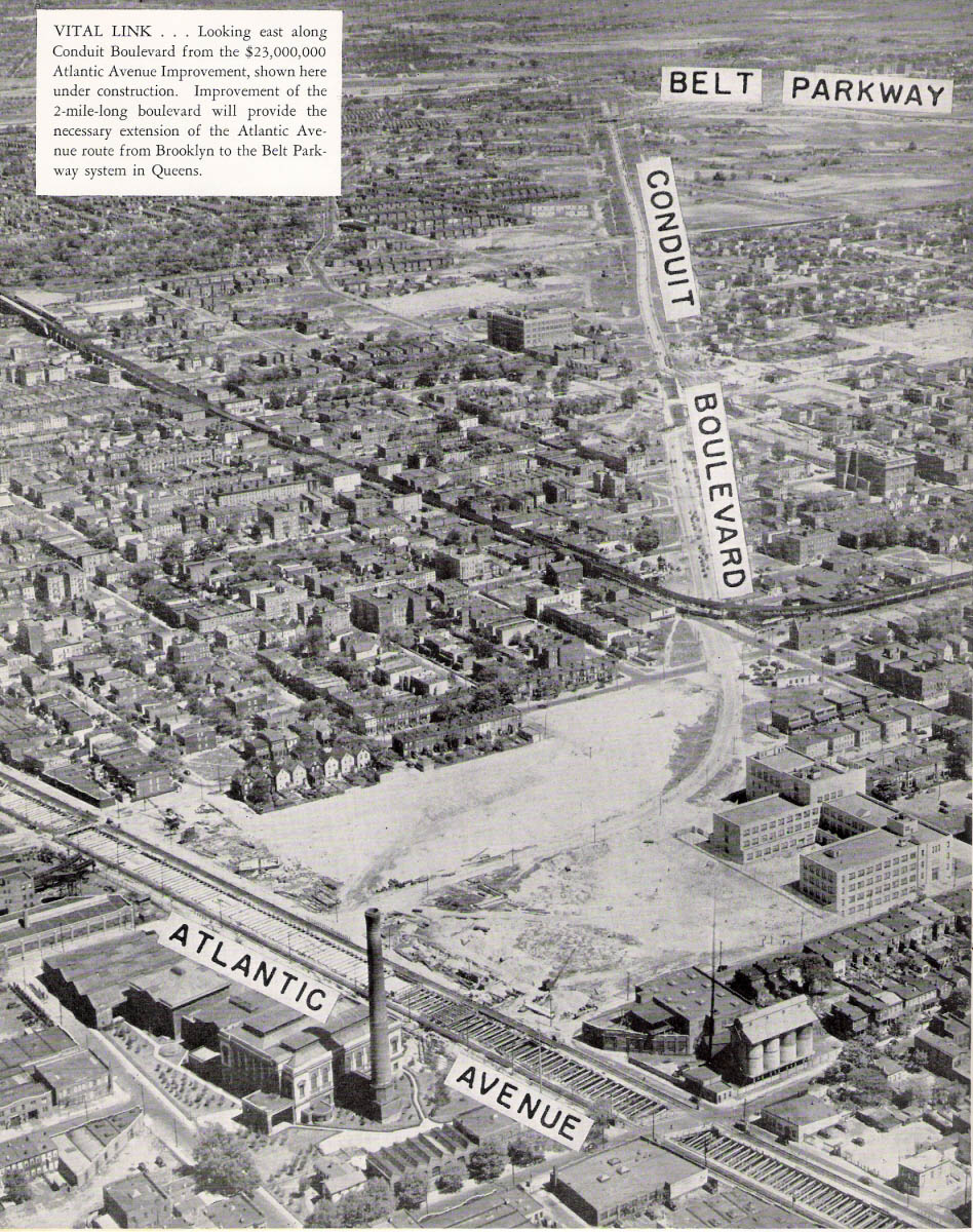 |
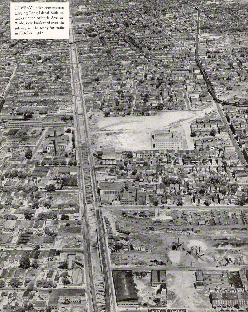
Aerial View, Atlantic Ave. construction and Conduit Blvd. These two aerial views from a 1941 magazine show the area right at the time they were preparing to move the LIRR underground and the development of Conduit Boulevard.Thanks to Neil Sullivan for this contribution. Tim O'Reilly recalls those 4 connected silos on the south side of Atlantic from the pumping station belonged to "Diana Coal", formerly Rubel's company, a coal and ice delivery company. |
|
| Fountain Avenue to Doscher Street | |||
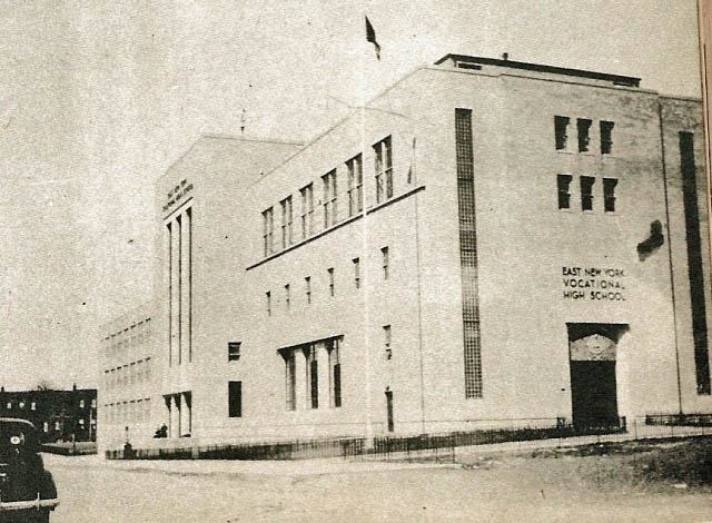 |
I've grouped these streets together partially beacuse they connect or wrap around the portion of land once housing some of the pumping stations for the Water Works, and by 1941, East New York Vocational High School. We have a page dedicated to the school here | ||
 |
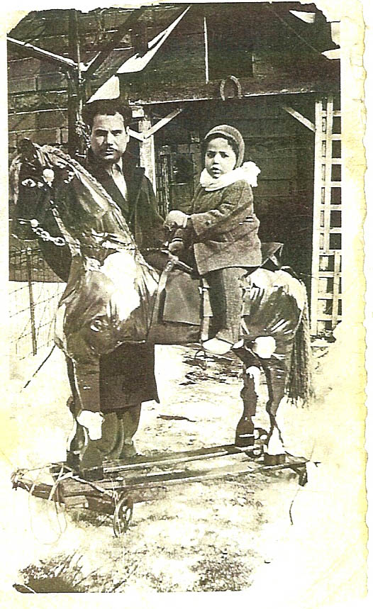 |
Crystal Street, 1940s Thanks to Caroline (DeGennaro) Noto and her sister Maria Lena DeGennaro for these Crystal St. shots. On the left is their father Joseph (Penu) circa 1944 with friend Ralph Bruno, sent in by Caroline. On the right from Maria is the backyard at 39 Crystal. Their father made these horses as a hobby and coupled with Dan Bivona's shots of his grandfather's "Ship in a bottle" hobby makes me wonder if other folks had grandparents with creative hobbies. If you have shots, send them in, we will start a page! |
|
 |
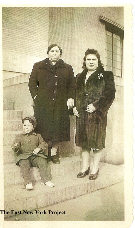 |
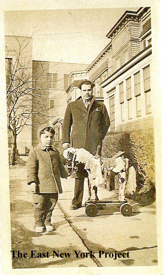
Crystal Street, 1940s From Maria, a nice view circa 1945 of brother Anthony on a version of the hobby horse with dad Joseph, looking north up Crystal towards ENY Vocational. On the right, sister Caroline sent in this shot on the steps of ENY Vocational circa 1944, of grandmother Maria Colantouni, mother Antionette, and brother Anthony. |
|
 |
St. Lydia's, Southeast corner Glenmore Avenue and Crystal Street, 1959 Founded in 1906 in a hall at Milford and Blake Avenue, the congregation moved into this former German_American Reformed Church building in 1907. Lawrence Smith wrote me because he was attending Transfiguration in Cypress Hills and Father Dibble of Transfiguration was also leading the Mission at St. Lydias; Lawrence played the organ in church and at times played for the St. Lydia's Mission. He described the interior; "...seemd more like a small theater. The altar and sanctuary was below in the middle of the room. When you entered the front doors all the pews were very high up from the sanctuary. You had to walk down the rows to get to the sanctuary area." Deeds show the building was sold to the Little Rock Baptist Church in 2016 and serves that congregation today . |
||
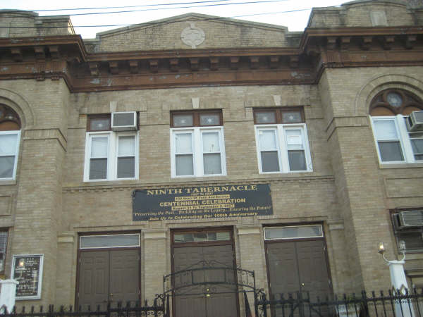 |
Former Atereth Israel synagogue and Talmud Torah, 87 Fountain This building was recently (2024) nominated for State and National historic status. Constructed in 1923 for the Tehereth Israel congregation (founded 1913), it was designed in the Renaissance Revival style by architect William Winters. In later years it housed the Kingsline Jewish Center. In 1974 it was acquired by the Ninth Tabernacle Church of God and Saints of Christ, a Black Hebrew Jewush Congregation formerly situated in Bedford-Stuyvesant. |
||
 |
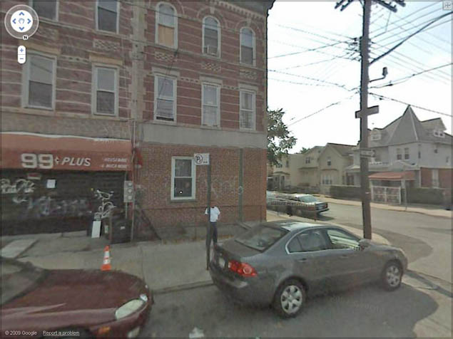 |
Fountain and Glenmore, 1941 and 2009 I stumbled on this odd-looking tax photo. I had doubts that the stone faced storefront and the Victorian on the corner would be still be around, but lo and behold some of that stonefront is still there and so is the Victorian! |
|
 |
 |
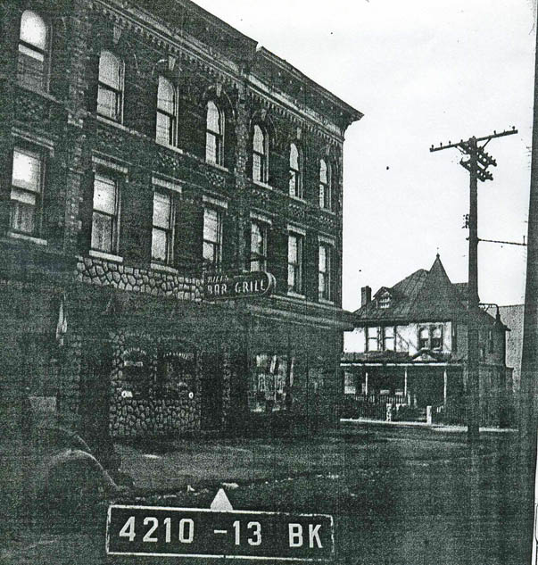
Death Wish 3 Not exactly East New York's shining moment. Death Wish 3 (1985) was shot primarily in East New York and this was one of the locations. You can see the stone-faced storefront still had the 1941 look and was not covered yet. In the picture on the right you can see the column of a formal-looking building at the left edge of the image. See below. |
|
 |
 |
New Lots Post Office This building was the New Lots Post Office, built circa 1920. Located on Glenmore Avenue closer to Crystal Street, it was sold to a tile company in the 1960s. By then there was a Cypress Hills office on Crescent Street and a new office opened down by Sutter Avenue. The 1941 image on the right shows the building when it still served as a PO. |
|
 |
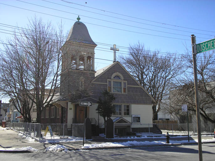 |
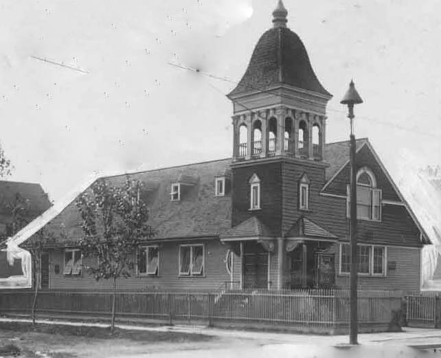
Glenmore Avenue Presbyterian Church Neil Sullivan sent this image of the church on the southwest corner of Glenmore and Doscher. The congregation and the building date to 1899. There was some friction with the East New York Reformed Church since a German-American Reformed Church was being constructed a block away at the time (that building was eventually taken over by St. Lydias.) The image on the left is from 1913. |
|
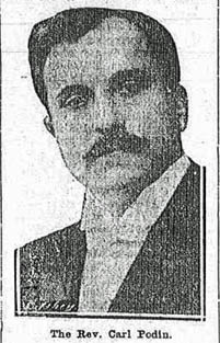 |
Carl Podin, Pastor (1912) The founding pastor of the congregation is Charles T. Berry, but Carl Podin has the deepest involvement with the early history of the church. Exiled from his native Latvia for his religious beliefs, Podin assumes the pastorate in 1908. Around 1912 the congregation is shocked to discover the church has been sold with no one's knowledge! It seems when the building was first constructed in 1897, it was not designated a house of worship and real estate taxes were accumulating until the property was sold as a tax lien. Podin manages to get it all straightened out, but leaves the congregation in 1918, only to return in 1924. As far as I have been able to determine, he served up to 1940. |
||
 |
 |
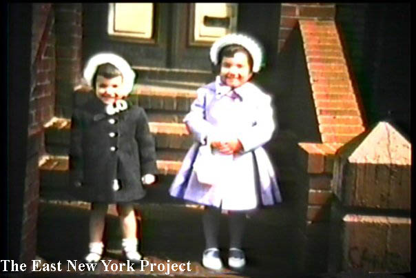
55 Doscher, between Pitkin and Glenmore Ed Mannarino noted that his mother's house is one of the few left standing on Doscher from the 1950s. Ed did not have pictures but captured screen shots from home movies, many of which he has posted on his Facebook page. Ed also sent shots of his grandfather's place on Loring Avenue (see bottom of page.) The shot on the left is from 1961 and on the right the 1956 is looking across the street. |
|
 |
 |
55 Doscher, between Pitkin and Glenmore I've included one shot looking north to Pitkin, with the old Fulton Elevated line in view, and one south towards Glenmore Avenue, both around 1956. |
|
 |
 |
55 Doscher, between Pitkin and Glenmore Ed Mannarino also tracked down the 1940 and 1980 tax photos of 55 Doscher. The porch combined with the bay window is a pretty unusual architecture. Ed also confirmed with his Uncle that his grandfather built the brick stoop seen in the pictures above. |
|
| Euclid Avenue, south of Atlantic | |||
 |
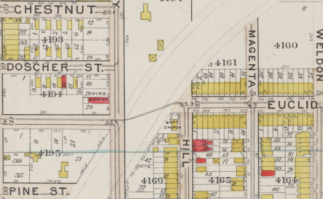 |
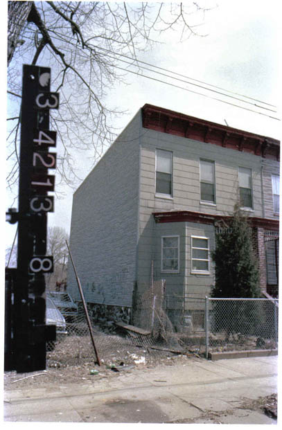
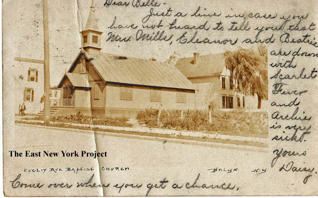
Euclid Ave. Baptist Church Maker: RPPC Dated:1905 Status: Own (RG) With the help of Alan Heins and a 1908 plat map we have pinpointed the old church and its history. This building dates to 1905 but the roof is destroyed in a storm in 1923 and the building is condemned. The house behind the church is still standing and the empty lot where the church stood belongs to that house. Eloise Wendell recognized the buildings in the background which faced Hill and they played in that empty lot as children. |
|
 |
 |
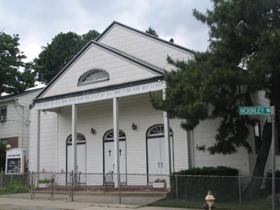
Euclid Ave. Baptist Church, Drew and McKinley From the terrific "Forgotten-NY" site, a shot of the Church located where Drew meets McKinley, built in 1925. Thanks to Kevin for their permission. Alan Heins provided the image of a Vacation Bible School class circa 1940, taken on the church grounds. Alan provided a nice history as well. In the history there is mention of a Benjamin T. Hock. We heard from one of his descendants, Ben Rieth, who added some background; "To my knowledge, he was a large supporter of the community. Had law offices in various Brooklyn neighborhoods, bought coal for poor people in the winter, was an avid boxing and Dodger fan. He was also probably the last Republican District Attorney in Brooklyn and unsuccessfully ran for judge."  |
|
 |
 |
Euclid Park, 1946 This began as a mystery photo from Thom Henrickson. Thom is pictured with his mother in 1946. It was Rod Maggio who recognized the building in the background and realized it was Euclid Avenue, south of Blake Avenue. That triggered some research on that specific area and Euclid Park. |
|
 |
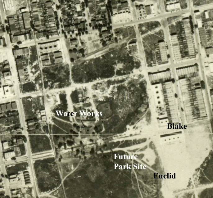 |
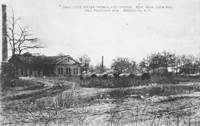
New Lots Water Works and Woods Dated:1909 Maker: Shinske Status: Need This Shinske post card from 1909 and the 1924 aerial image on the right shows the early undeveloped lot running between Fountain and Euclid Avenues. Rod recalls playing in the abandoned Water Works buildings in 1940s. Note the building in the background of Thom's photo was not constructed yet in 1924. |
|
 |
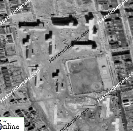 |
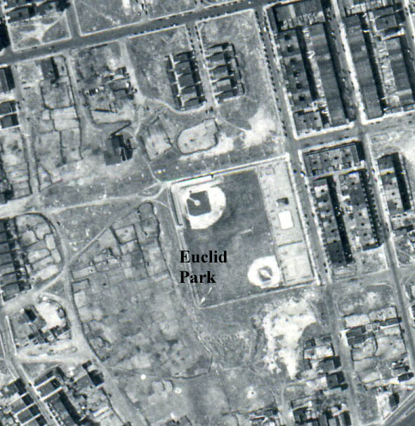
The 1951 aerial image on the left shows the park and the playground. The baseball field hosted some pretty serious Kiwanis leagues (see below). The image on the right, courtesy of historic aerials.com, shows The Cypress Hills Projects going up around it, but not completed, in 1954. | |
 |
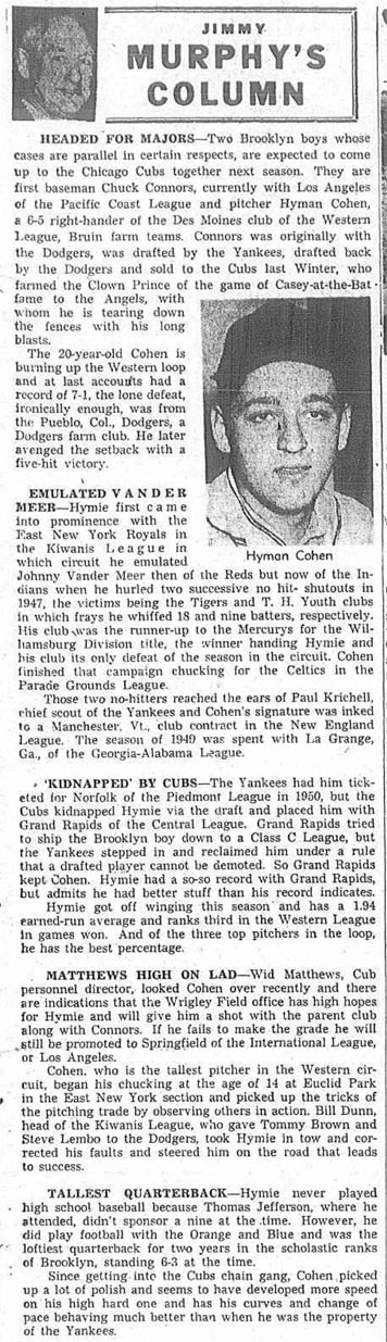 |
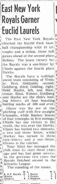
I dug into the Brooklyn Eagle to present some stories about the league which played at Euclid Park. The first is from August 10, 1948. The second article, from June 2 1955, discusses Hyman (Hy) Cohen who pitched there and was signed by the Yanks. This article noted that Hy attended Jefferson but they did not field a team at the time (war years maybe?) Hy did make it up "for a cup of coffee", appearing in 7 games for the Cubs in 1955. | |
 |
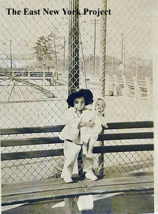 |
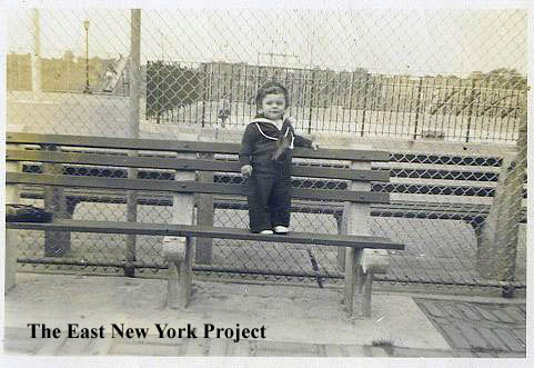
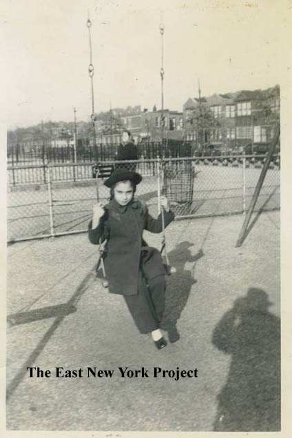
Anthony Messina, one of our research gurus, supplied some family pictures of the park in the 1940s. These two are of his cousins, the on on the left taken in 1942 (looking west from Euclid)and the one on the right circa 1945. | |
 |
 |
Two more from Anthony, taken in 1949. The first is looking north with Euclid Avenue on the right. The shot on the right was taken further down Euclid By Linden Boulevard. | |
 |
 |
Anthony Messina also supplied us with two 1943 family images taken in the same area. Both shots are along Sutter Avenue with Euclid in the background. Anthony points out the Cypress Hills houses were built on that empty lot. | |
 |
 |
The park is still there, seen in a 2010 Google maps aerial. On the west side of Fountain Avenue, down by New Lots Ave., is I.S. 218. Thanks to Neil Sullivan for the photo. | |
| Hemlock, Pine, and Crescent Streets, south of Atlantic | |||
 |
 |
Hemlock Street and Belmont Avenue, 1960s The first view south along Hemlock Street across Belmont Avenue. The second is east along Belmont from Hemlock. Almost all the buildings in these 2 images are still standing. |
|
 |
 |
In the same general area, these pictures were submitted by Anthony LaViola. The one on the left was taken in front of 610 Pine Street in the 1950s, of Anthony and younger brother Joe. In the distance on the left is St. Fortunata's and on the right I believe are the Louis H. Pink Houses. On the right, the view ,is north along Pine Street toward Blake circa 1954.Left to right, Eddie Cohen, Santo Conigliarro, Joe LaViola, Tony Conigliarro. | |
 |
 |
Also from Anthony LaViola, in front of 610 Pine Street on Easter 1957: top Anthony Conigliarro, Anthony LaViola; (lower) Joseph LaViola and Santo Conigliarro.On the right, mothers Lee Conigliarro and Nina LaViola circa 1955. | |
 |
Rich Inguardia sends over this 1961 image of Crescent Street, between Blake and Sutter. Featured are "Larry Interanti. Unknown, Charlie Pugusli, Mike DiGiovanni, Joe Recupero, John Carneglia, Unknow, Rich Ingardia, Casper ." | ||
 |
 |
A World War II era image; a rally supporting the troops on Pine St. and Sutter Ave. in 1942. Anthony Messina supplied the 2008 view. We have the entire collection of images from the parade with views of Pine Street and Sutter Avenue which can be found on the Sutter Parade page. | |
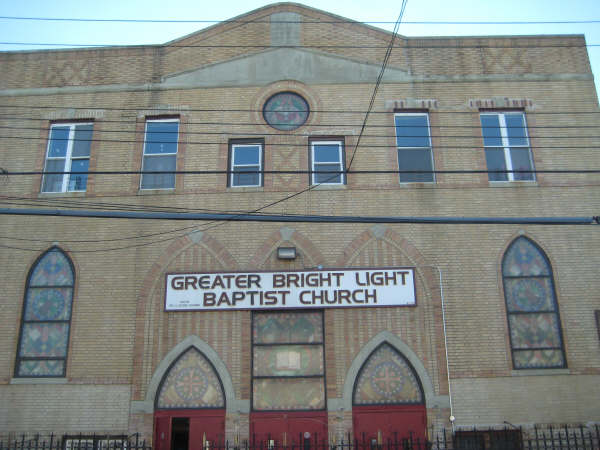 |
Synagogues Chevre Tomchai Torah, located at 1320 Sutter over by Crescent. It became Greater Light Baptist Church in 1990. Thanks again to Demetrius for these shots. |
||
 |
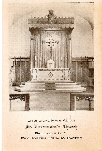 |
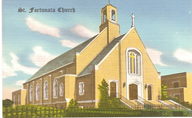
St. Fortunata Maker: Nationwide Specialty Dated: Unk Status: Own(RG) St. Fortunata was founded in 1934 and the brick house of worship was completed at Crescent St. and Linden Boulevard in 1942. The 1942 promotional card at the right is an interior view of the altar and lists Rev. Joseph Schiano as pastor. It continues to serve the community today though the Parochial School was closed in 2008. |
|
 |
 |
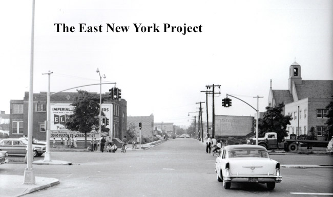
Crescent Street, North of Linden Boulevard, 1961 St. Fortunata is seen in the 1961 image. On the right, Rod Maggio forwarded over this wedding pic of "Ronnie and Stella", June 26, 1958. That's "Kid" Tony Ritsua behind the ring bearer." |
|
 |
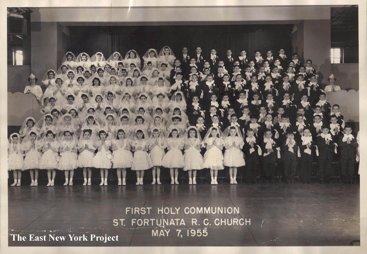 |
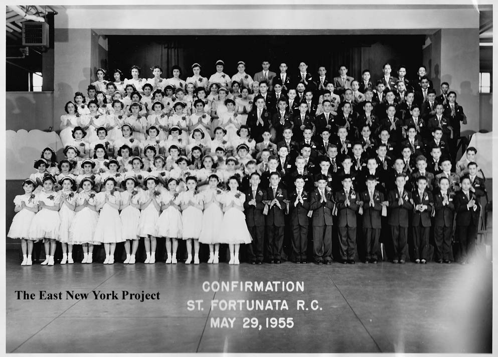
St. Fortunata Confirmation and First Holy Communion Classes, 1955 Big Thanks to Anthony LaViola for these 1955 pics of the huge confirmation and first holy communion classes. Anthony is second from the left in the boys' front row in the confirmation class pic. |
|
| The streets south of Atlantic Avenue, East of Conduit Boulevard | |||
| Liberty Avenue has its own page, click here | |||
 |
 |
McKinley Ave., 1939 South of Atlantic and east of Conduit Blvd., this next series come courtesy of Eloise Wendell. Both shots are McKinley Ave. between Euclid and Crescent. In the first shot she identifies Sonny Elbert on top of the car holding her brother Ken, and from left to right Aunt Lilly Kunz, unidentified friend, mother Helen, and Aunt Helen Gallagher. The second shot is mother Helen, father Larry and her brother Ken. |
|
 |
 |
Hill St., 1940s Two more from Eloise.A view down Hill Street in 1948 (l to r) Janet Cronin, Barbara Pasasak, Eloise. In front is Carolyn Cronin. The second shot is Eloise with Donald Smith near the corner of Hill and Euclid in the 1940s. |
|
 |
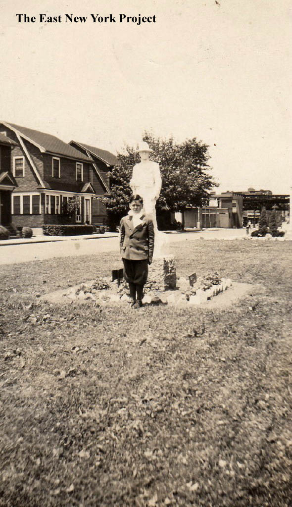 |
Hill St., 1950s Eloise explains that those hedges are the left were known as 'Frank's Hedges' and made a popular picture taking shot. The view is east from 19 Hill St., towards Crescent Ave. In the shot are: Maureen Benlein, Lillian Slickas,Irene Lloyd, Barbara Rudiak and Malcolm Klotz . The second shot is of her late brother Ken on his confirmation in 1951, on Elderts Lane near Liberty Ave. The statue is a tribute to casualties of WWI. . |
|
 |
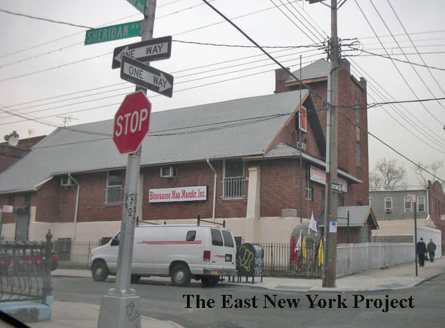 |
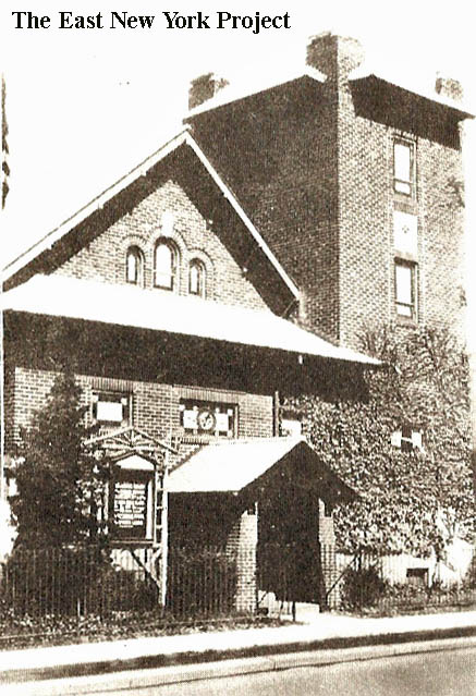
Goodsell Memorial Methodist Episcopal Church, 1938 Located on the northeast corner of McKinley and Sheridan, the church started as a Sunday School in 1888 under the leadership of Rev. Charles Tomlinson of Wesley Methodist. It was named Goodsell after Bishop Daniel A. Goodsell. In 1891 a small wooden chapel was built on this location, expanded in 1896 and continued to serve the Sunday School after a brick structure was completed just west of it in 1916. Now a Hindu Temple. |
|
 |
 |
Goodsell Memorial Methodist Episcopal Church The original building is seen in a 1908 real photo postcard on the left. The 1904 picture on the right appeared in a Brooklyn Eagle article in 1938 celebrating the Golden Anniversary of the church. This building continued in use alongside the brick 1916 edifice. It was damaged slightly by fire in 1963, and was still standing in 1966. |
|
 |
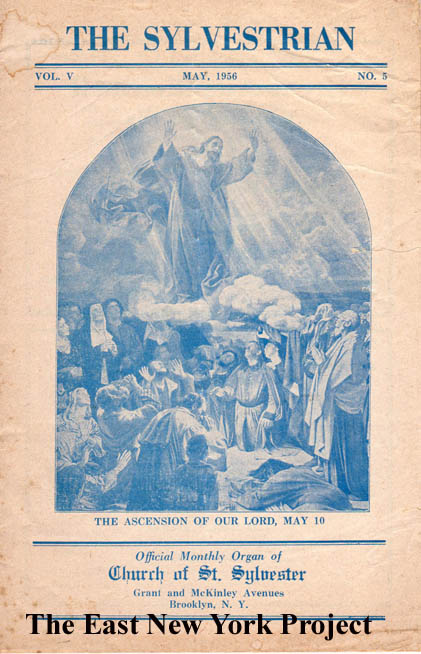 |
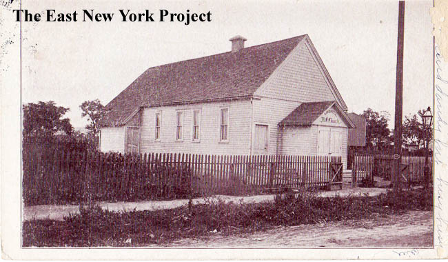
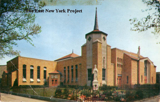
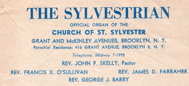
St. Sylvester's The church is located on the northeast corner of Grant and McKinley. It was organized in 1923 and the first church of wood-frame construction was completed in 1924. The new building dates to 1955. On the right is a 1956 copy of the Sylvestrian, a monthly newsletter. Judy Close tipped me off that there was a 90th Anniversary booklet produced for the church, if anyone has a copy we could scan that would be a great help. |
|
 |
> 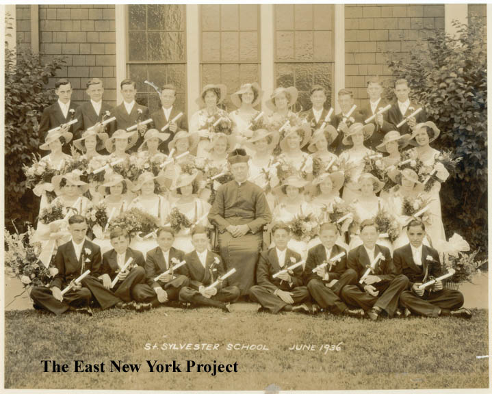 |
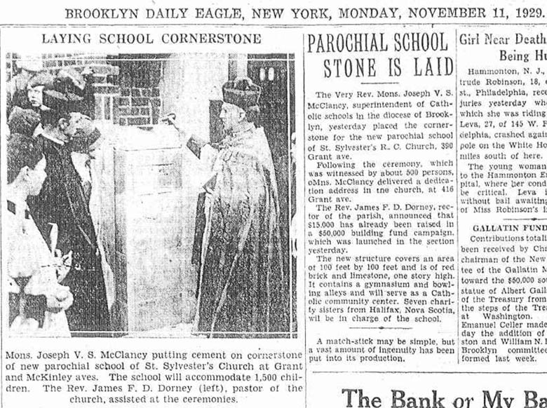
St. Sylvester's School On the left is a Brooklyn Daily Eagle picture and article noting the cornerstone dedication for the school in 1929. Father Dorney, on the left, was the founder of the church. Located on Grant Avenue just north of McKinley, the school was closed in 2011 as part of consolidation that included St. Rita's, St. Michael's and St. Malachys into the new Salve Regina (using the St. Michael's Girls High School building). This is a link to a Youtube video from Bobby "Flash" Gennaro on the closing. Brian Merlis sent over the 1936 class picture on the right. I believe it was taken by the original wood-frame church building, since the school was brick. |
|
 |
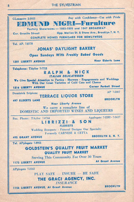 |
St. Sylvester's From that monthly newsletter, including a page of local ads. |
|
| South of Linden Boulevard | |||
 |
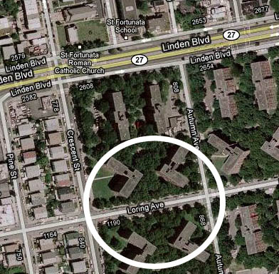 |
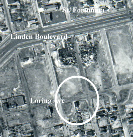
Loring Avenue, 1950s Ed Mannarino's grandparents lived on Loring Avenue, before the property was taken to build the Pink Houses project. I used a 1951 aerial photo to try to pinpoint the property, east of Crescent Avenue. In my research I found that Loring was once known as Lorraine Avenue, and as with most of the land south of Linden Boulevard, remained fairly undeveloped up to the 1950s. |
|
 |
 |
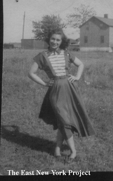
1201 Loring Avenue, 1950s Oddly, Ed did not have pictures, but he does have 8mm footage and used screen capture software to produce these images from the 1950s that display the rural quality of the area. That's Ed's mother in the pictutre on the left. |
|
 |
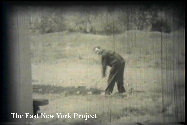 |
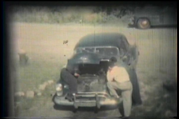
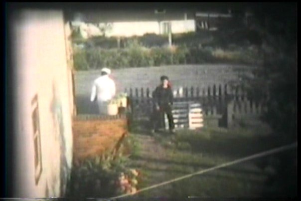
1201 Loring Avenue, 1950s Ed has a large number of these shots up on his Facebook page. That's his grandfather tilling the soil. Ed explained that they were not running a farm, they were planting for themselves. |
|
 |
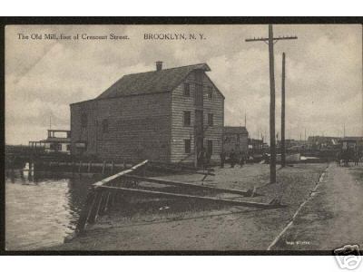 |
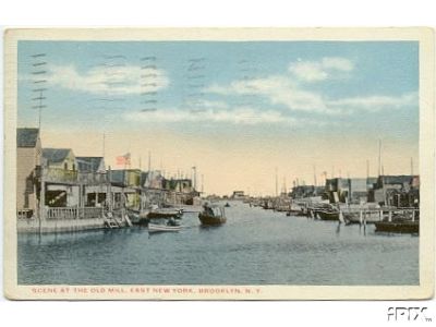
Scene at the Old Mill, East New York Dated: 1910 Maker: Commercial Post Card Co Status: need Old Mill, Foot of Crescent St. Maker: Wm. Fick Dated: 1900 Status: Need None of us would consider the foot of Crescent by Jamaica Bay "East New York" but at the turn of the century this was considered part of that area. There is now a page devoted to the Old Mill here |
|