|
        |
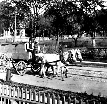
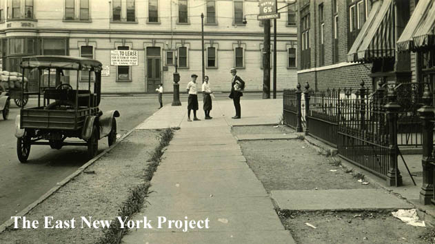
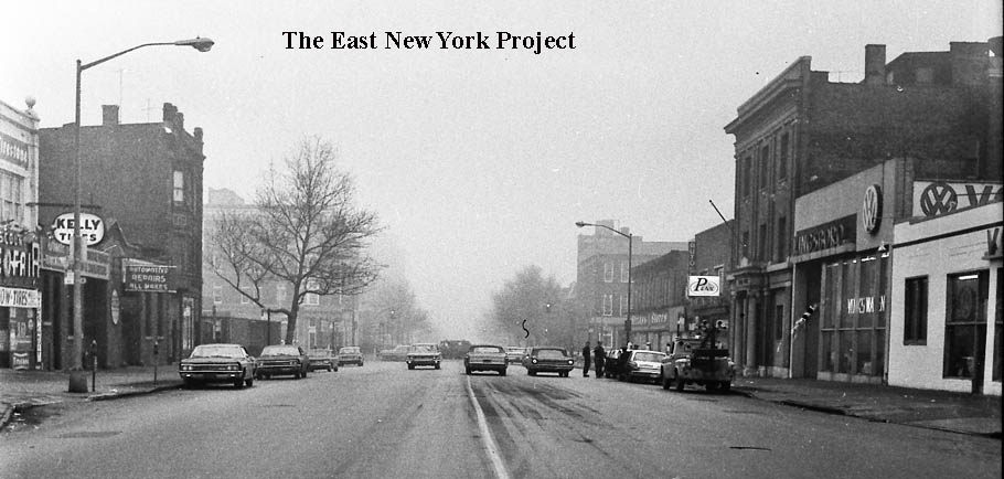
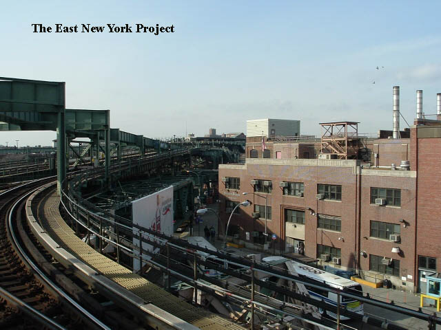
Zone 1NOTE: I have begun breaking down Zone 1 into streets; Schenck, Hendrix, Van Siclen, Bradford and Wyona have their own pages in the dropdown menu. Generally the area west of Barbey, north of Atlantic, excluding the Sunnyside area which I have placed with Highland Park. A series of farms covered this area, Van Siclen being the most familiar name.Click on thumbnails to enlarge |
|||
 |
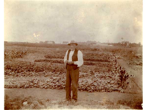 |
Miller Orchard and Farms Maker: Wm. Fick Dated: 1911 Status: Own(BG) The first image is around 1911, showing the orchards on Miller's farmland, the area north of Jamaica we associate with Sunnyside. That is Miller's house in the background. The picture on the right is from 1898, in the area around Miller and Van Siclen Avenue. |
|
 |
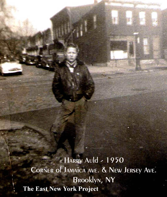 |
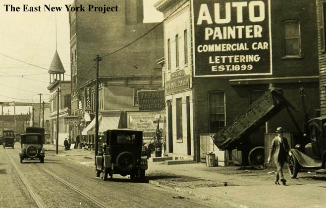
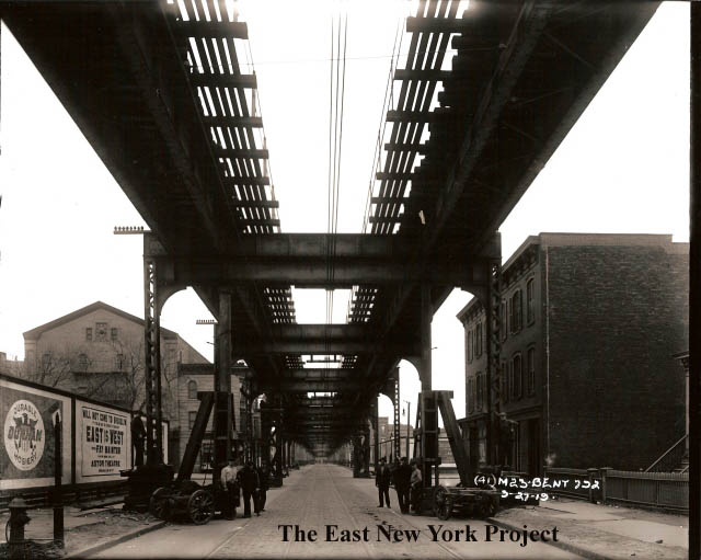
Vermont and Jamaica Ave. This 1923 view is looking west down the north side of Jamaica Avenue from Vermont. The tall four story building is the Schmidt Brewery, and beyond it, the Breitkopf Hotel. Jack Auld noted that the side street is Marginal Street east, and comments on the building on the northeast corner (mostly blocked by the building with the "Auto Painter" sign on the side). "My Uncle Woody Theurer ( who was my godfather) lived upstairs in that building and ran 'Woody's Auto Service Cente' downstairs there, that was in the early to late 40's." Jack also supplied the 1950 image on the right looking north across Jamaica Ave. towards Marginal Street East. |
|
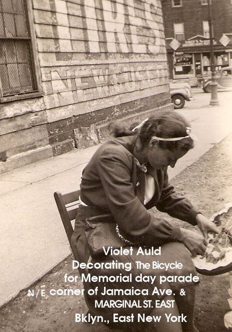 |
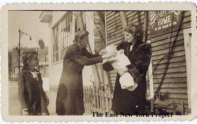
> | Marginal Street East. One more view from Jack, this time looking south in the 1940s. Pictures is Violet Auld, decorating her bike for a Memorial Day parade. |
|
 |
>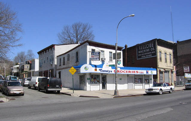 |
Marginal Street East. Jack also sends a closer look at Marginal Street East, and also an update view of that corner, looking north across Jamaica Avenue from New Jersey Avenue. That "Kellobe Machine Co." sign appears on a few websites that specialize in finding the old faded ads on the sides of buildings. |
|
 |
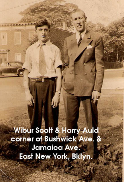 |
Jack Auld also supplied this shot taken on Highland Boulevard in 1944, by the Interboro overpass. Jack is the little boy in the photo. On the right, also from Jack, a view by Jamaica and Bushwick Avenues. | |
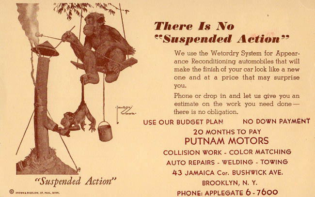 |
As evidenced by the many early pictures, this stretch of Jamaica Avenue was heavily dominated by the auto service industry. Judging solely from the way the phone number is presented I'm guessing this ad card is from the early 1960s. | ||
 |
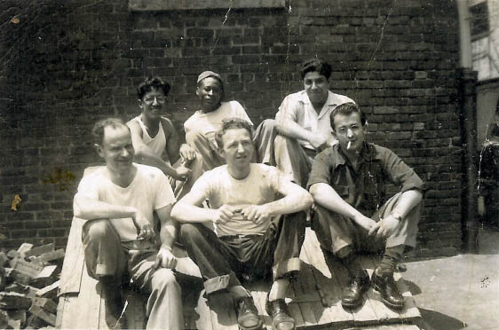 |
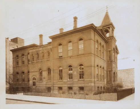
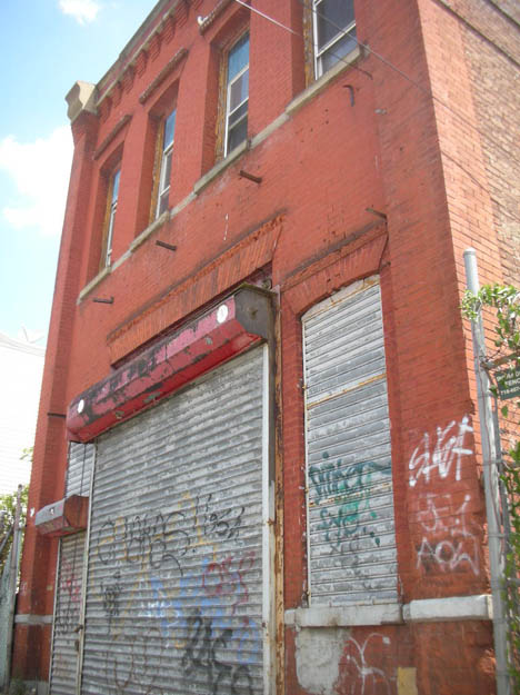
P.S. 61, Fulton and New Jersey Avenue This photo is from the 1930s and identifies the school as a "reformatory school". Constructed in 1884, it became an annex to P.S. 76 in 1896. In 1913 it was designated as a "Probationary School", where the other local public schools could send their problem students. It was closed in 1939, and in the 1940s it was used by "home relief" to give out clothes to the needy. Sam Feldstein bought the building in 1946, and converted it into a dinette factory and showroom. The 1950 shot on the right is of my dad and coworkers outside of the building. Feldstein sold the building in 1976, and it was demolished by 1980. Now serving as a parking lot.  |
|
 |
 |
Fulton Street, east from New Jersey Ave., Ca. 1966 On the left is the converted P.S. 61, when it was Sam Feldstein's dinette factory and showroom. My father, a trained mechanic, explained that he took a job there right out of high school because employers were avoiding draft-eligible workers. After the building was demolished around 1980, it served as a parking lot and used-car sales lot for over 40 years. In 2024, a new residential development, 2667 Fulton was opened with a lottery for 28 apartments available to low-to-medium income families. The rendering on the right conveniently leaves out the elevated line along Fulton Street. |
|
 |
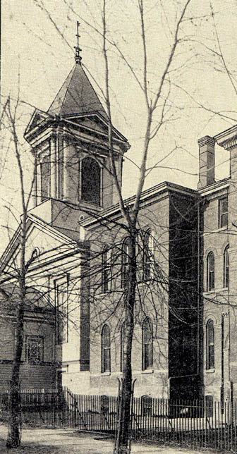 |
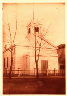
East New York Reformed Church The first church in East New York was the New Lots Reformed Church (1824) and the new congregation was formed by members of that church who lived in the northern part of ENY and found the distance onerous. Founded in 1840, the first building was constructed on land donated by John R. Pitkin, on New Jersey Avenue just north of Fulton Street. That building, pictured on the left, was sold to the Trinity Episcopal congregation in 1854 and moved to Wyona Street. The replacement underwent a huge renovation in 1891, and is see on the right in 1892 next to P.S. 61. |
|
 |
 |
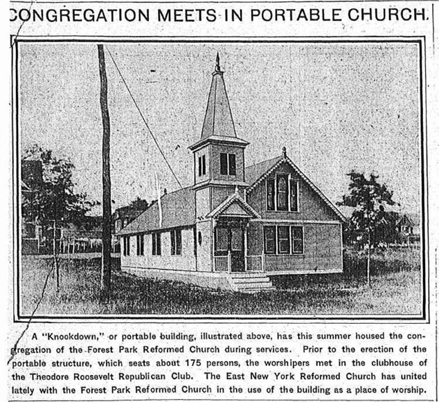
East New York Reformed Church It soon became evident the Dutch and German population was moving away, and in 1906 the congregation bought land on the southwest corner of Ashford Street and Arlington Avenue in a plan to move east. That strategy was abandoned, and instead the church merged with the Forest Park Reformed church in Queens in 1910. An apartment building was constructed on the former church site in the 1920s (seen below) but even that is gone and today is an empty lot. The complete list of pastors is on the right. |
|
 |
 |
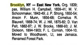
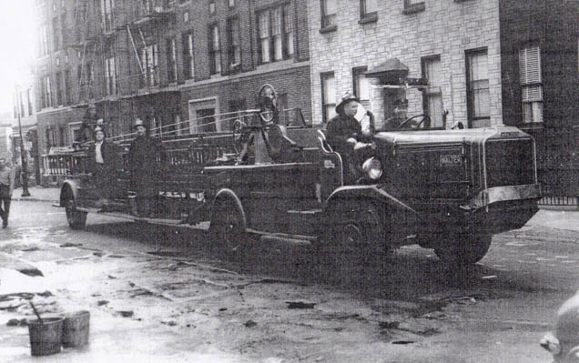
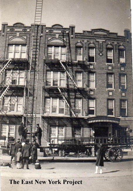
Hook and Ladder 107, New Jersey Avenue Jean Kestel sent over the picture on the left, and Jack Auld supplied the one on the right, both taken in the 1930s. The ladder company dates to 1886, and for a short while was housed around the corner on Jamaica Avenue. It took residence here in 1899. Jean's view on the left is the west side of New Jersey Avenue, across from the firehouse. In Jack's shot, the apartment building to the right of the firehouse replaced The East New York Reformed Church. |
|
 |
 |
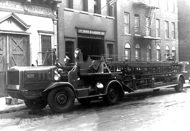
Hook and Ladder 107, New Jersey Avenue When I acquired the image on the left it was erroneously identifed as Vermont Street, but that is the same building on the west of New Jersey Avenue as Jean's image above. It was taken in 1922 and you can see a big difference in the trucks. The Ladder co. moved to 799 Lincoln in 1970. Ladder 175 replaced it, but moved to 165 Bradford in 1985. This building is still standing, as seen in my 2010 photo, and it appears to be be serving as a warehouse. |
|
 |
Thanks to Tony Davenport who loaned me a copy of the 1968 East New York Savings 100th Anniversary Book. This shot is looking down Pennsylvania Avenue towards Fulton Street. I'm more interested in the billboard on the left; its for the Feldstein's dinette shop seen above. | ||
 |
 |
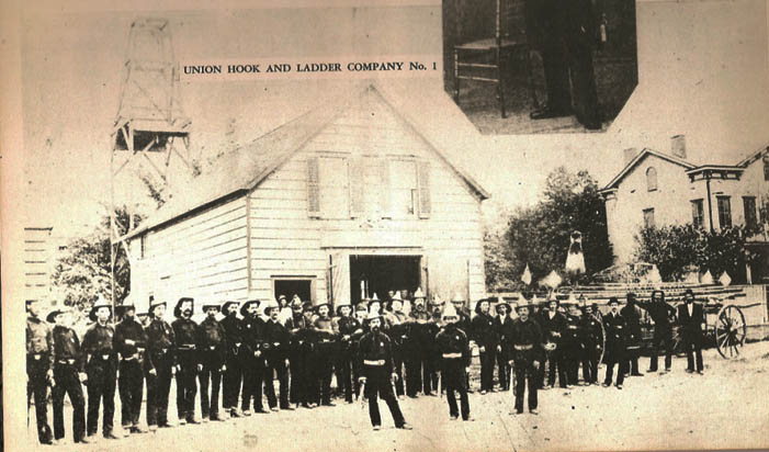
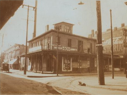
Pennsylvania and Jamaica Ave. Union Hook and Ladder#1 was formed in 1862 and the firehouse was located on Plank Road (Jamaica Ave). I'm guessing this shot dates from the 1870s, from "Good Old East New York". The firehouse was replaced around 1900 by Kloster's brewery, which became the L. Brietkopf hotel and Brewery in 1912. The view on the right is north up Pennsylvania towards Jamaica from Fulton Street in 1929. By then the brewery was closed. The City demolished it to create access to the new Interboro Parkway. |
|
 |
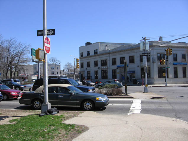 |
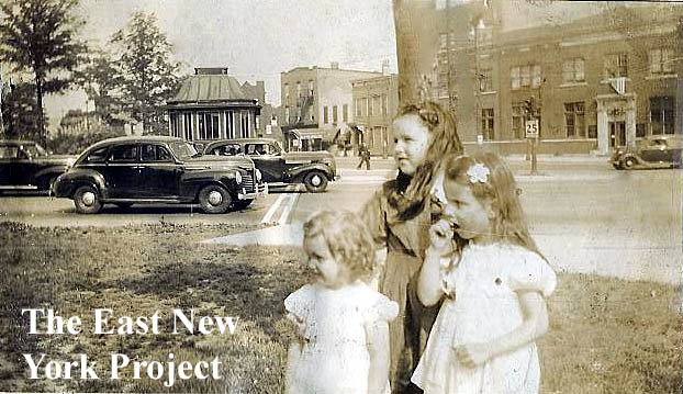
Pennsylvania and Jamaica Ave. On the left, Jack Auld supplies a photo of the intersection from the late 1930s. The view is southeast, the small building at the entrance, according to Jack, served as a tollbooth and later a parkway police booth. The girls in white are Geraldine and June Theurer, the third girl is unidentified. In the background, the building with the fire escape is 94 Jamaica Ave., Jack's residence. The Citizen's bank is visible on the right. On the right, Jack supplies an updated view from the same angle. |
|
 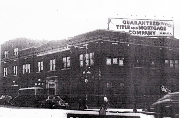 |
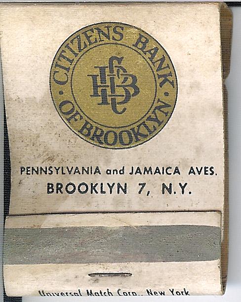 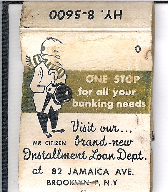 Citizen's Bank of Brooklyn Citizen's Bank of BrooklynI don't have much history on the bank, located on the southeast corner of Jamaica and Pennsylvania Avenues. Frederick Heidenreich, author of Old Days and Old Ways in East New York, was president of the bank. In the 1923 Brian Merlis archive image on the left, you can see Heidenreich's name at the bottom of the sign. Thanks to Joanne Montgomery for the 1941 tax photo. My brother Lou supplied the matchbooks (1960s?) and we know today Citibank has a branch in this building. |
||
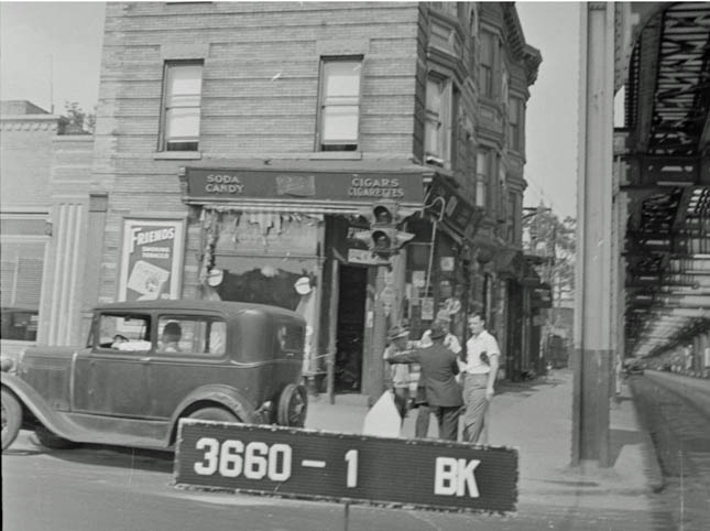 |
Northeast corner, Pennsylvania Avenue and Fulton Street, 1940 Harvey Shapiro's grandfather owned the corner store seen in the image and he offered some memories; "My grandfather's store was on the corner of Pennsylvania Ave and Fulton St. He had the old soda fountain, sold cigars (big humidor that I had to replenish the water tray) comic books and magazines, canned goods, etc. He helped many people if they didn't have enough money. My Aunt Rose used to run the store with him. Spent every afternoon there when I was in kindergarten ( half a school day at P.S. 76 back then.) Knew many of the police, as they'd come into the store to have a sandwich, coffee, warm up in winter, or use the bathroom.My Aunt Rose and I used to walk the newspapers around the corner to the firehouse on New Jersey Avenue. Hook and Ladder #7.. They all came to know me as a little boy, and when they returned from a call, they would turn onto Fulton St. from Pennsylvania Ave. and honk the horn and ring the bell as I stood by the large glass window waving, saying "they're my friends" |
||
 |
 |
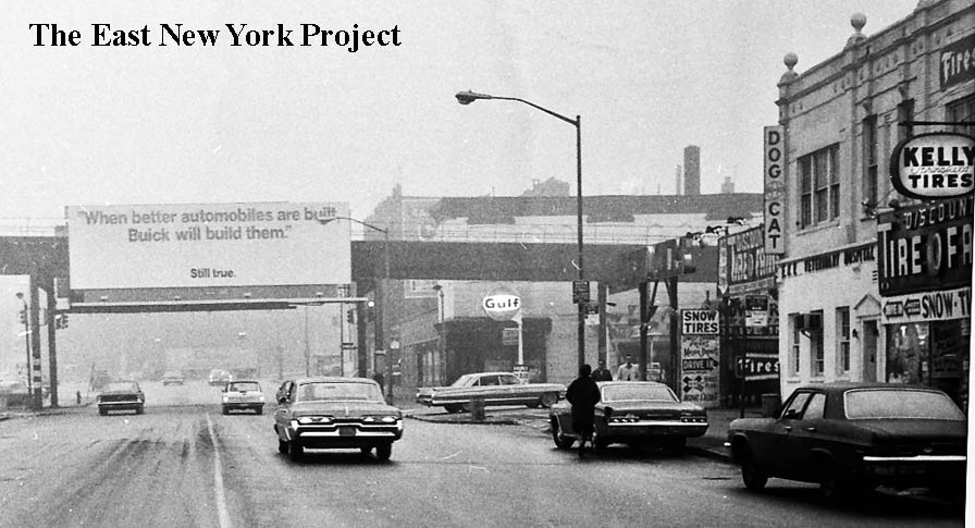
Pennsylvania Avenue and Fulton Street, circa 1967 The first view is looking north toward Fulton and the el. A dog and cat hospital can be seen on the right. The second view is the reverse, looking south down Pennsylvania Avenue toward Atlantic Avenue. |
|
 |
Pennsylvania Avenue, 1930 This image was taken in 1930 by P.L. Sperr. It is the west side of Pennsylvania Avenue between Fulton and Atlantic.The building on the far left appears to be the only one standing in the 1967 image below. |
||
 |
 |
Pennsylvania Avenue and Fulton Street, Ca. 1967 These views are the west side of Pennsylvania Avenue. The first is looking south from the old Tyrian Temple and the second is north toward Fulton Street. |
|
 |
Mondone's Stables, 1905 This great shot comes from Jack Auld, whose grandfather, Dan Davis, is referenced in the photo caption. Jack believes the stables were located on the northeast corner of Georgia Avenue and Fulton Street. |
||
 |
 |
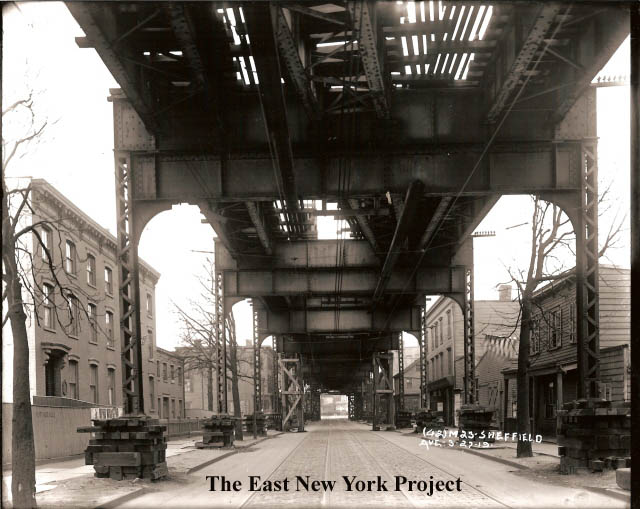
Fulton St., west of Sheffield, 1919 These two shots, from the Brian Merlis collection, show Fulton Street looking west and east from Sheffield Ave. in 1919. The large building on the left was the Wartburg Lutheran Home for the Aged.That building was on the 1893 Plat maps so it was there for some time. In the distance on the right the building with the sloped roof was Bookmans Dry Goods (see below). I need some train buff to explain that third track in the middle of the El. Fulton, East of Sheffield 1919 Penn Fulton Hall can be seen on the left facing Pennsylvania Avenue. It was an important meeting place in the early days of East New York; the 1st library was also located there and plans to build the Arlington Library were discussed there regularly. My question; where is that middle track we saw in the other image facing west? UPDATE: Bob Andersen, who runs the great Lirrhistory website, informs me the third track was simply a crossover track, which disappeared when the Alabama Ave. station was extended shortly after these pictures were taken. |
|
 |
 |
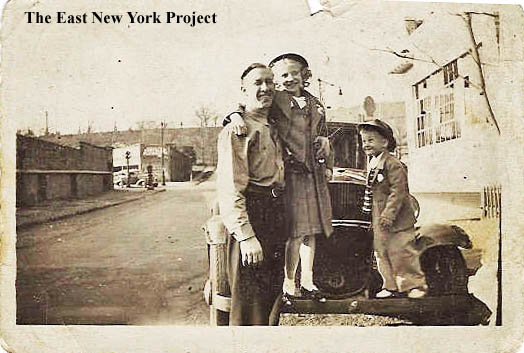
Fanchon Place Jack Auld supplies us with shots of Fanchon Place, that short street running between Jamaica and Bushwick Avenues. On the left is Jack with his dad Harry and Marilyn Merkel in front of 30 Fanchon around 1944. |
|
 |
 |
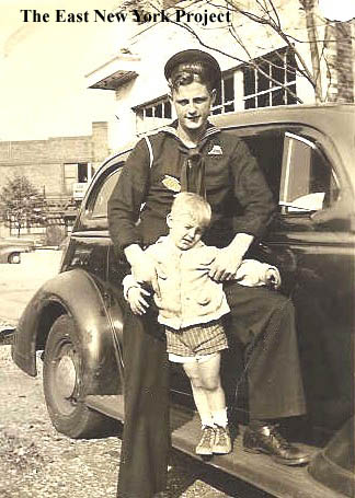
Fanchon Place Two more views from Jack of Fanchon Place during the war era. That's Jack with his uncle Jack Davis on the left and the two women in the right photo is two of Jack Davis's sisters Charlotte Theurer (Davis) and Ethel Davis, Young girl is daughter June Theurer and her baby brother Woodrow Theurer |
|
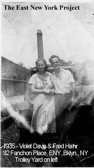 |
Fanchon Place Jack supplied the caption for this 1935 view, and noted the chimney in the background which belonged to the trolley yard was blown down in a hurricane a few years later. |
||
 |
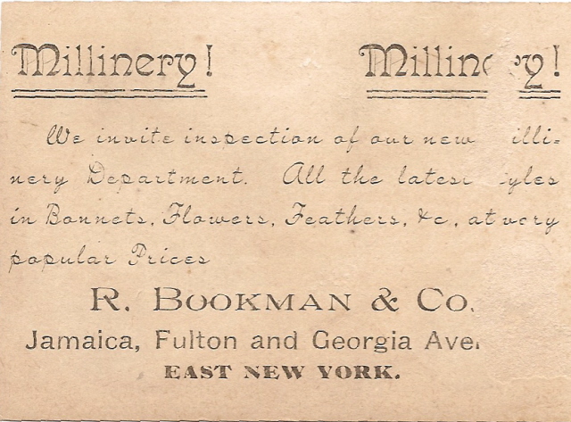 |
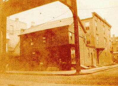
Northwest corner, Fulton and Georgia early 1900s. Identified as the location of Bookman's Dry Goods from 1852 to 1874. Started by Max and Adolph Bookman, this was apparently a significant business; "practically everyone in New Lots and many in surburban towns patronized them" (From "Old Days"). Ralph Bookman took over (the "R" on that card). |
|
 |
 |
Georgia Avenue and Fulton Street, April 29, 1966 This pair off the corner of Georgia and Fulton features the Wartburg Lutheran Home for the Aged. The first image is looking east down Fulton Street, and the Wartburg Home is on the right. The second image is looking south down Georgia Avenue from Fulton Street. The chapel belonging to the home is on the left. In the far distance we can see the billboard for Piels. |
|
 |
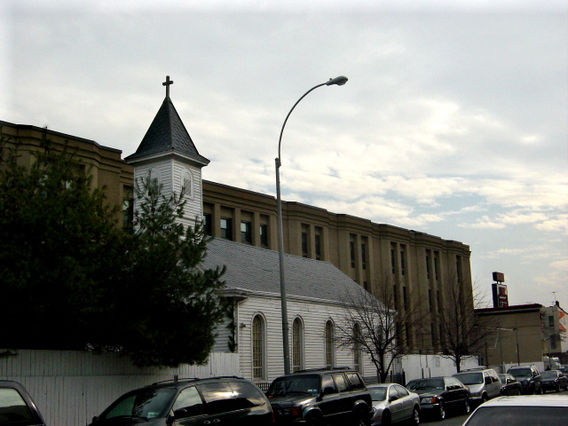 |
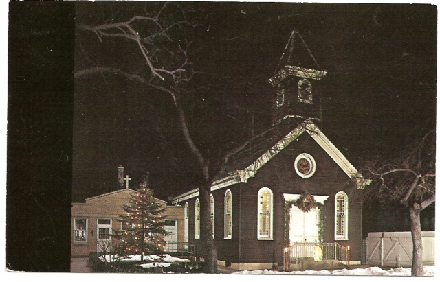
Wartburg Lutheran Home Chapel, Georgia Ave. The Wartburg Lutheran Home, pictured above,sat on Fulton Street. The chapel serving the home was on the east side of Georgia Ave.(15) between Fulton and Atlantic as seen in the promo postcard on the left in 1962. The 2007 update photo on the right shows the chapel parallel to Georgia Ave; I assumed they moved it at some point?. |
|
 |
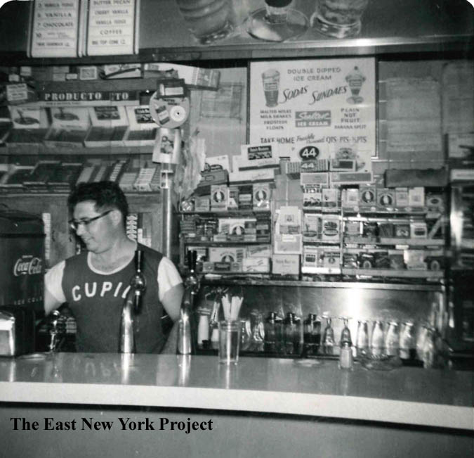 |
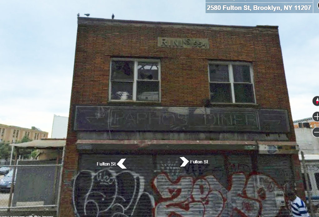
Rini's Bakery, Fulton Street off Georgia Avenue The original Rini's bakery was located on Atlantic Avenue off Wyona Street and can be seen on the Wyona Street page. It was owned by Matteo Rini, and his brother Ned was a boxer who fought under the name Jackie Coburn. Matt Rini informed me the family sold the bakery to the Morabito family and opened a luncheonette in this location; the family name is still atop the building. On the right, a 1957 picture of Matt's dad Joseph in the luncheonette. |
|
 |
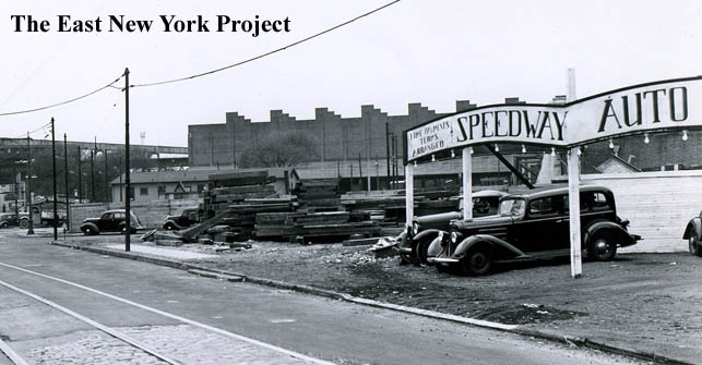 |
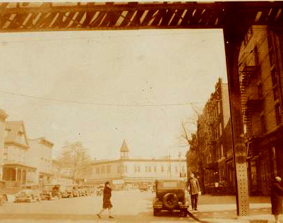
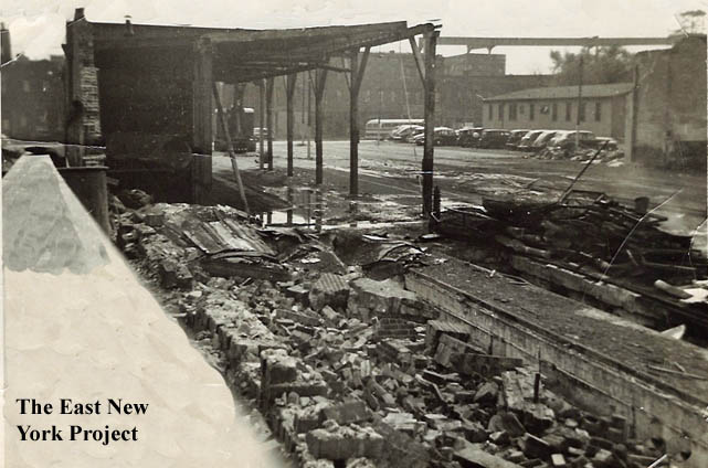
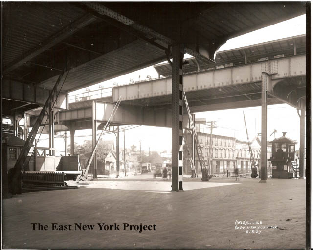
Destruction of trolley barns, Jamaica Avenue This shot comes from Jack Auld, and I have struggled with the orientation. Jamaica Avenue is in the background and the path on the right is part of the yard. On the opposite side of that building on the right is the defunct Gillen Place, which was removed for the transit garage. The Brian Merlis archive photo on the right is a view west down Jamaica from Sheffield Avenue in 1939, and I used that building on the right to help with the orientation. |
|
 |
Howard Hotel, Alabama and Atlantic. The Howard Hotel sat on the northwest corner of Atlantic and Alabama Ave. Built by Philip Reid in 1853, it was the stopping point of the steam trains from NY and was considered a grand hotel in its day. This shot is of its inglorious end as a laundry, before it was razed in April 1929. |
||
 |
 |
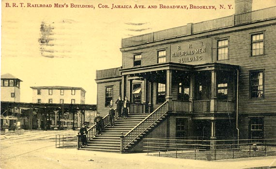
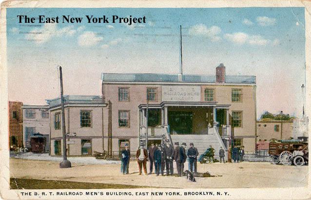
BRT Clubhouse Dated:1910 Maker: Wm. Fick Status: Own (BG) Card#2 Dated 1907 Maker Seyffarth Status: Own(RG) The BRT building sat where the original Howard's Tavern was located. For a short while it served as a YMCA branch. |
|
 |
 |
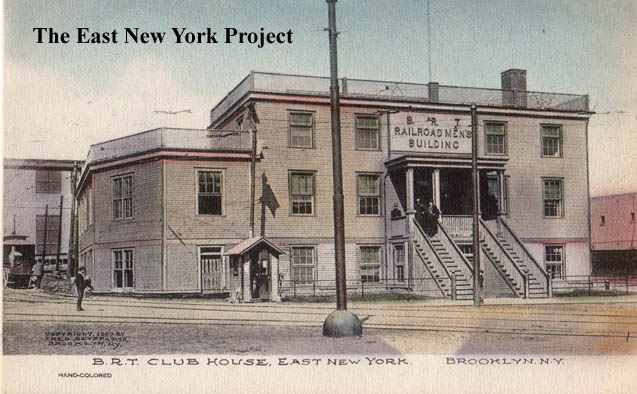
BRT Clubhouse Maker: Commercial Art Post Card Co. Daetd: 1921 Status: Own (RG) Neil Sullivan provided the 2006 shot of the location of the clubhouse, replaced by the bus depot in 1948. |
|
 |
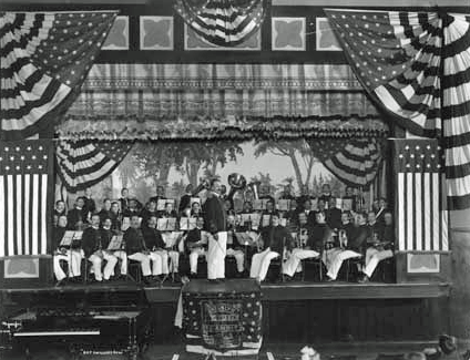 |
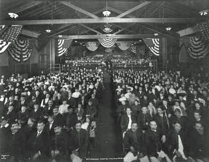
BRT Auditorium and Band Interior shots from 1906 |
|
 |
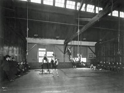 |
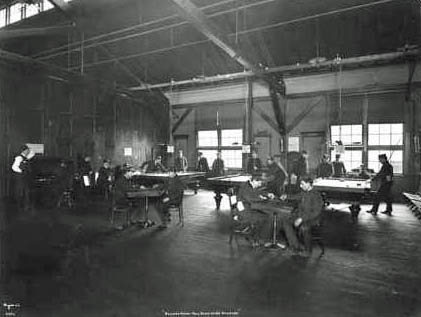
BRT Billiard Room and Gymnasium Interior shots from 1906 |
|
 |
 |
East New York Avenue On the left, a shot from the Brian Merlis archives, shows the intersection of East New York Avenue and Atlantic in 1923. Of particular interest to us was the "steeple" , visible in the distance in the center of the photo, of Trinity Hospital. We have a page devoted to the hospital here.On the right is a shot from the 1930s from aRRts aRRchives; it is taken from the exact same angle yet almost all the buildings have changed in just a few years. |
|
 |
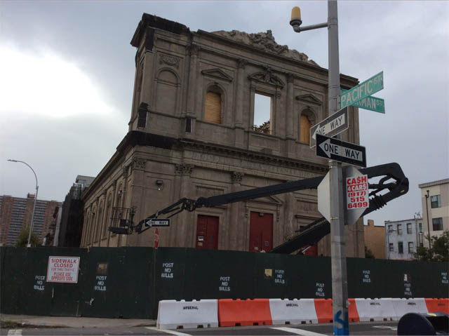 |
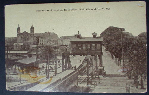
Manhattan Crossing, East New York(Brooklyn) Maker: Unk Dated: Unk Status: Need This is a reminder we do have an LIRR page, though it is a bit stale. I moved this card here because Father Philip Pizzo pointed out to me that the church in this image is Our Lady of Loretto. Located on the corner of Pacific and Sackman, it was founded in 1894 and was the local home of the Italian population before the founding of St. Rita's in 1913. The church, built in 1908, was lauded for its early use of concrete. Unfortunately efforts from community groups to save the church from demolition failed and it was demolished in 2017. There is a website Loreto Church, put together by a former member. |
|
 |
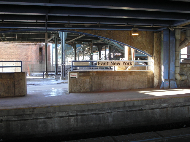 |
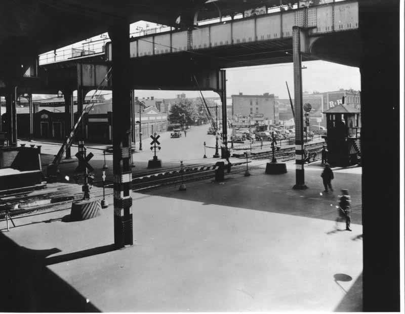
This view west from the East New York LIRR station in 1941 I wouldn't consider East New York today, but the building on the left housed the original East New York Vocational High School. The new building on Wells Street was about to open at the time this picture was taken but I believe this building continued to serve as an annex for awhile. It's still standing, but this stretch of Atlantic Avenue now has an overpass over the station, seen in Neil Sullivan's 2005 photo. | |
 |
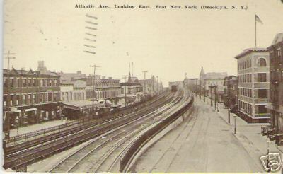 |
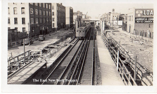
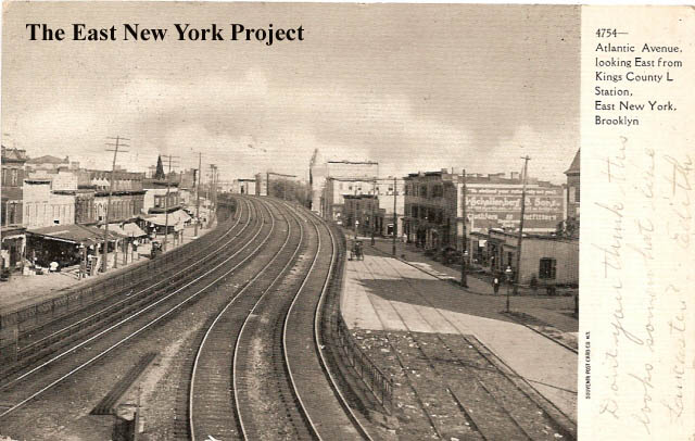
Atlantic Ave., Looking East From Kings County L Station Maker: Souvenir Post Card Co. Dated: 1907 Status: Own(RG) Atlantic Avenue Looking East, East New York (Brooklyn, N.Y.) Maker: Unk Dated: Unk Status: Need Two similar views, the card titles are self explanatory though I cannot identify any landmarks in the view. |
|
 |
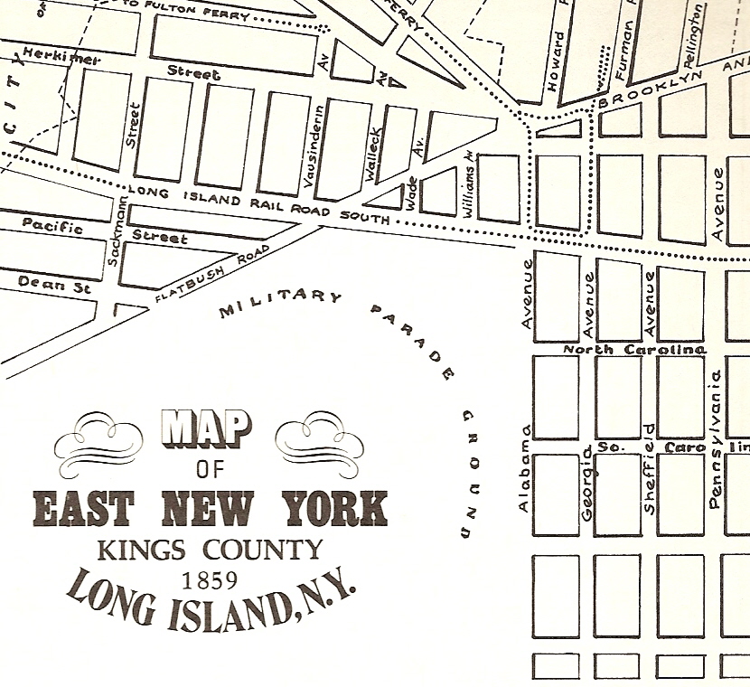 |
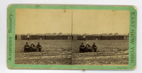
East New York Field Day I'm pretty certain we have pinpointed the area of this shot. The first clue I have extracted is from "Old Days"; "The Parade Ground was a tract of land west of Alabama Avenue where military reviews and drills were held." I've now included a map taken from the inside jacket of Landesmann's book, "History of New Lots" It shows the location of the parade grounds. |
|
 |
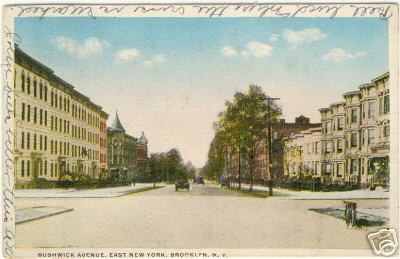 |
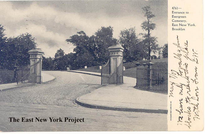
Entrance to Evergreen Cemetery, East New York Dated: 1907 Maker: Souvenir Postcard Co. Status: Own(BG) Bushwick Ave., East New York Brooklyn Maker: Commercial Art Dated: Unk Status: Need Two views of Bushwick Ave. We have a page devoted to Evergreen Cemetery. |
|
 |
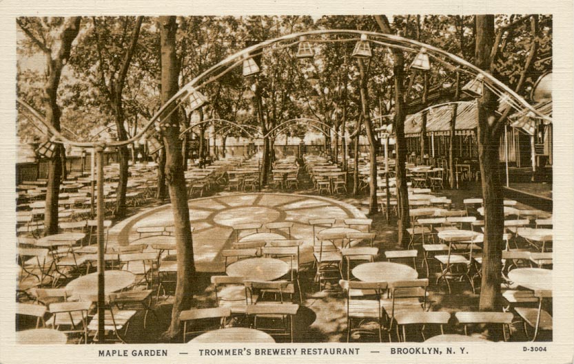 |
Trommers Brewery I'm probably cheating a little bit into Bushwick here but Trommers was a big local brewery and the garden shot in the postcard on the right is the closest I have to an image of the beer gardens that were popular in the early days. Trommers was located on the south side of Bushwick Ave. off of Conway St. The image on the left, from the Brian Merlis archives, is a view north across the transit yards. I'm not sure what that large building is in the distance on the left. Trommers sells out the plant to Piels and closes in 1950. There is a neat little history of Trommers located here. One tidbit; John Trommer starts the brewery in 1897 by buying the brewery of Stehlin & Breitkopf. Note the hotel mentioned in the shot of Jamaica Ave. and Pennsylvania. It was a common strategy back then for breweries to have ties to restaturants and hotels. |
|
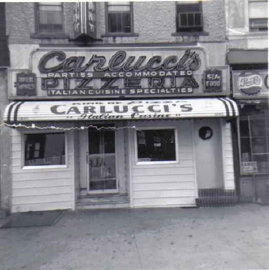 |
Carlucci's Dominick Mondelli sent in this shot of Carlucci's, which sat at 1845 Eastern Parkway. A neighborhood favorite, Carlucci's served from 1950 to 1977. |
||
 |
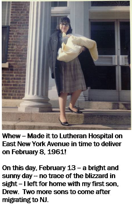 |
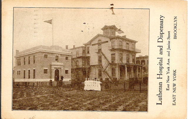
Lutheran Hospital and Dispensary, East New York Ave. and Junius Street Maker: Unk Dated:1914 Status:Own(BG) Lutheran Hospital was opened in 1881 for "nursing sick and wounded", but not those with contagious diseases. Despite the name, it admitted all religious affiliations. The original building was also a converted private residence just like Trinity Hospital. Elsie Anzalone comes up with a shot from 1961 after the birth of her second child! The postcard has no manufacturer identified. |
|
 |
> 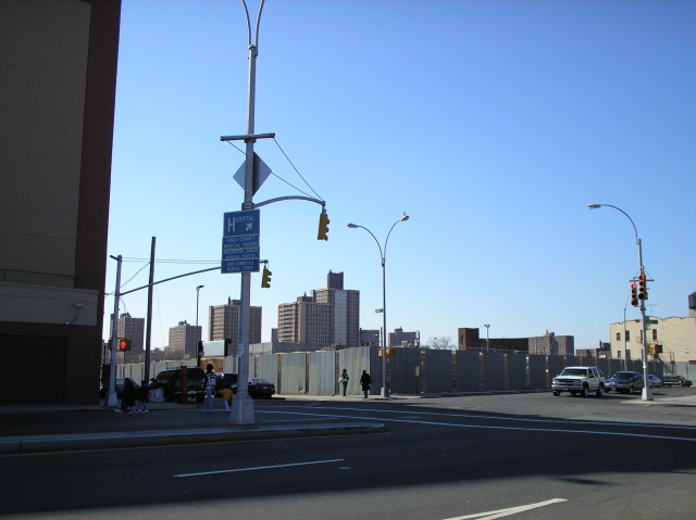 |
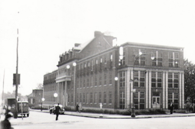
The cornerstone for the new hospital is laid on May 8, 1927. Neil Sullivan not only supplies a 1940 shot of the hospital but a shot of the location today in 2006; it was closed in 1979 and razed in the 1980s. | |
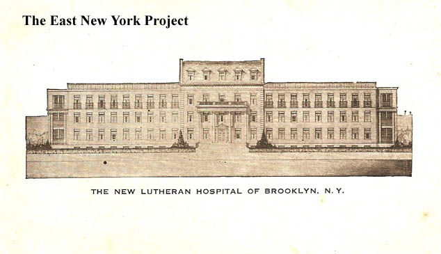 |
> 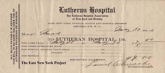 |
On the left, an undated promotional post card. On the right, a bill from 1916. I have the Lutheran Hospital bill my parents incurred from my birth in 1957; for laughs take a guess at the amount before checking under the trivia button.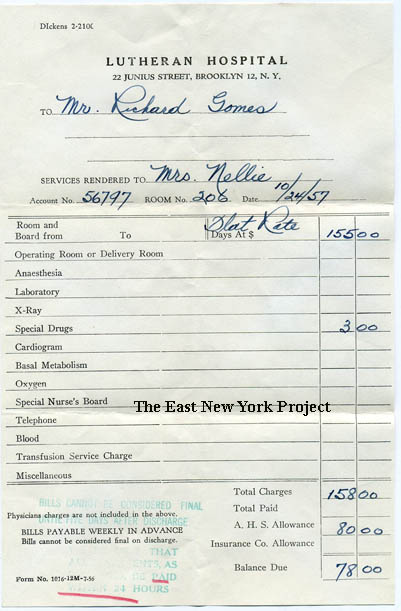 |
|
 |
 |
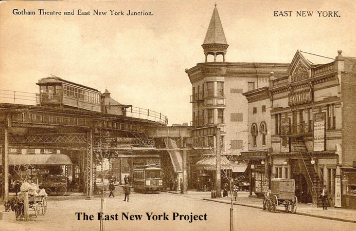
East New York Junction and Gotham Theater, Brooklyn Dated: 1914 Maker:P. Miller Status:Own (RG) The Gotham has a short but colorful history so I built a Gotham Theater Page. Neil Sullivan provided the 2005 image of the junction. Train buff Alan Zelaso explained to me that upper structure was for an express service that was never completed. |
|
 |
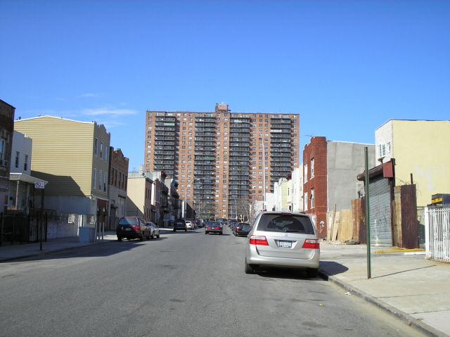 |
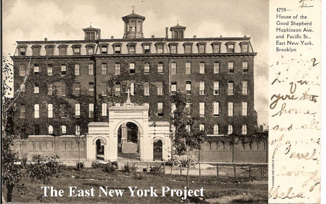
House of the Good Shepherd,Hopkinson Ave and Pacific Street, East New York Dated: 1907 Maker: Souvenir Post Card Co. Status: Own (BG) This building was a Catholic Reformatory for women and girls, built in 1875, the Brooklyn chapter of the organization was founded in 1868. It has been replaced with an apartment complex, seen on the right in a photo submitted by Neil Sullivan. I have built a full page with more photos and a history which can be found here. |
|