        |
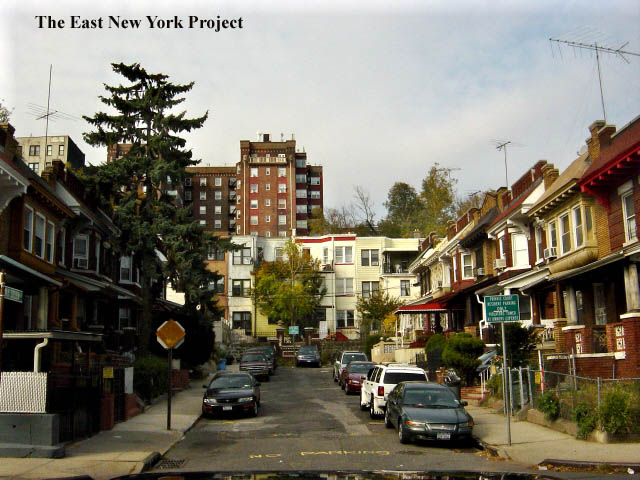
SunnysideNot really Highland Park, but part of the original farmlands on the north side of Jamaica Plank Road in the old days. Besides, Sunnyside had their own cool entrance into the park. Some shots here are repeats of shots posted in Zone 1 streets. |
|||
|
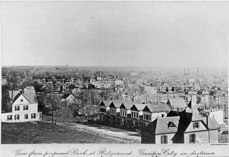
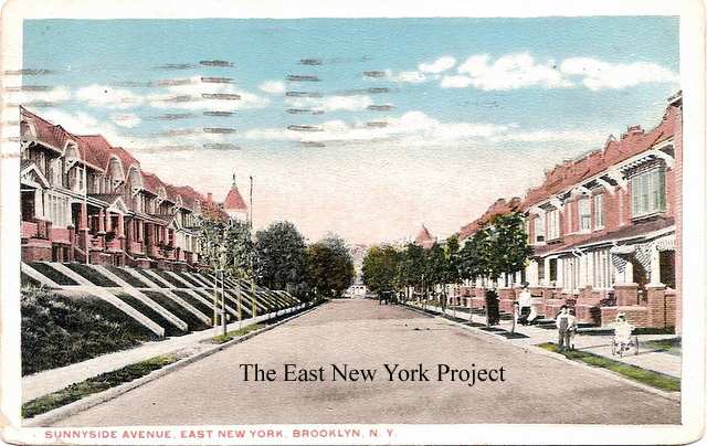
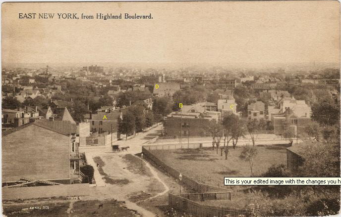
View of Sunnyside Avenue, 1889 This rare shot appeared on the Brooklyn Borough Annual Report of 1889. "The Proposed Park at Ridgewood" is of course Highland Park, but I have no idea about the reference to Garden City. The view is southeast from Highland Boulevard, and a partially developed Sunnyside Ave. is in the foreground. Those two large houses are still standing, as well as the row of smaller ones across the street. The Schenck House is visible in the distance, as well as the towers of the pumping stations. | ||
|
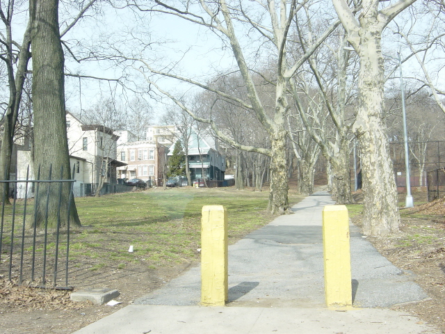
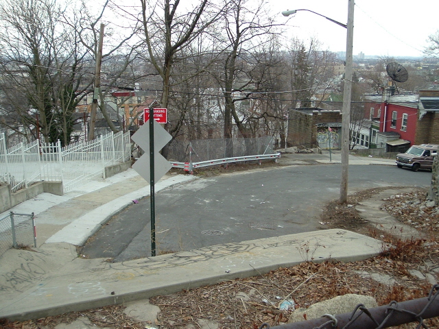
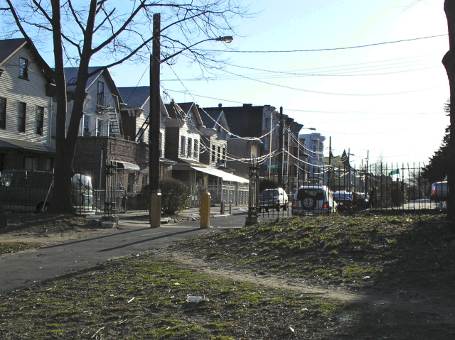
Warwick St. Entrance We grew up using this little strip to play baseball, prying up a few cobblestones for bases. The wrought iron fence which lined the path to Sunnyside in the back was a perfect home run fence. I don't see the fence (or the cobblestone) in this 2005 photo. Rod Maggio noted those yellow poles were to deter residents who were driving down that path to avoid having to back up on Sunnyside! | ||
|
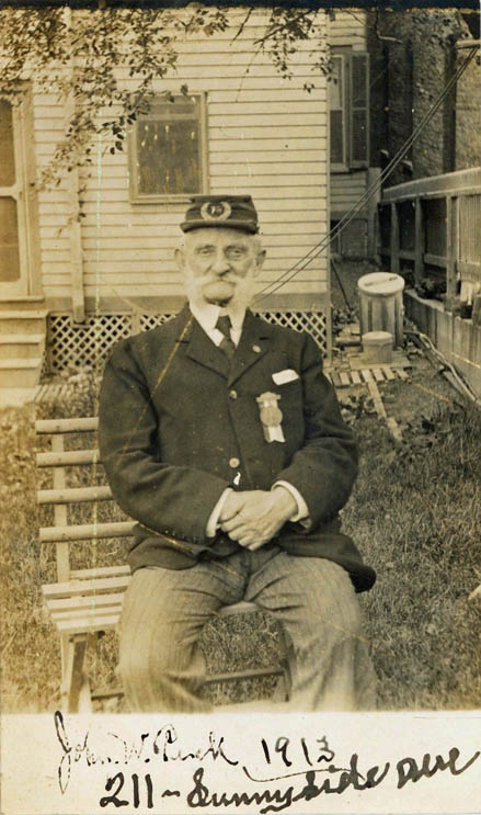
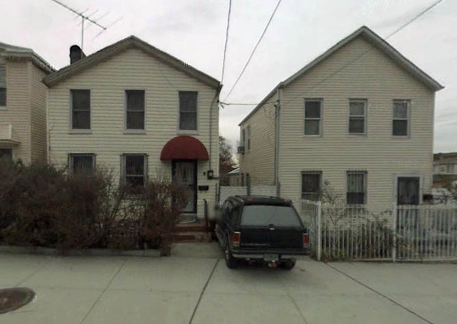
211 Sunnyside, 1913 This rare real photo post card features John W. Peck, Civil War veteran, posed in front of his home at 211 Sunnyside Avenue in June of 1913, shortly before his 70th birthday. I confirmed the name and location in the 1910 census. | ||

|
|
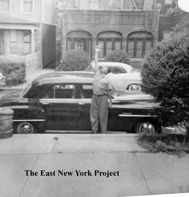
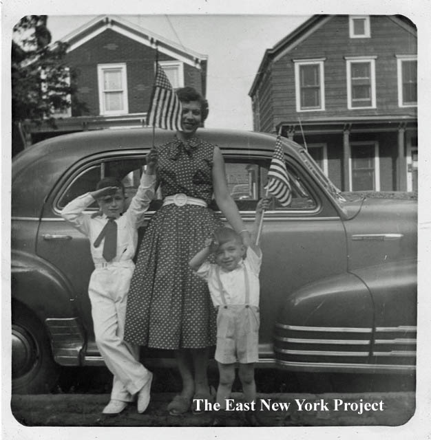
Stoopball, 1950s Gloria (Profeta) Gallaway lived at 239 Sunnyside, just the third house in from the park. She sent these pictures of her dad in the 1950s playing stoopball in front of the house. | |
|
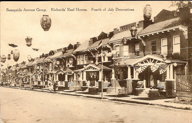
Sunnyside Avenue Group Richards Real Homes 4th of July Celebration Maker: Unk Dated: Unk Status: Own (BG) Here's an interesting card. It purports to be a neighborhood 4th of July celebration but in reality its probably a marketing gimmick for Richards Real Homes. The decorations are a bit too perfect and consistent. I believe this is the south side of Sunnyside, the back of these homes face Schenck Court. | ||
|
|
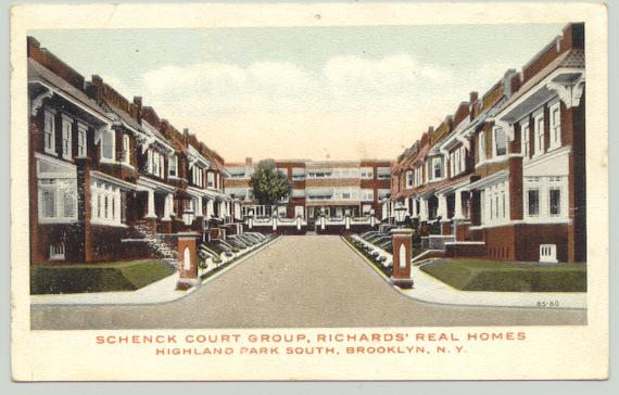
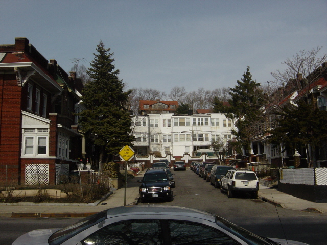
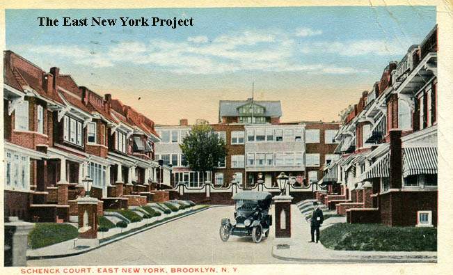
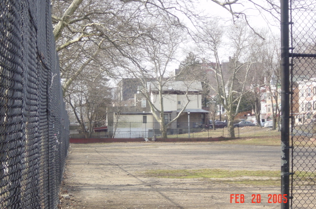
Schenck Court Group, Richards Real Homes Maker: Unknown Dated: Unk Status: Need. Richards Real Homes developed a lot of the Sunnyside area; most development occured between 1900 and 1920. The shot on the right is from 2005. | |
|
|
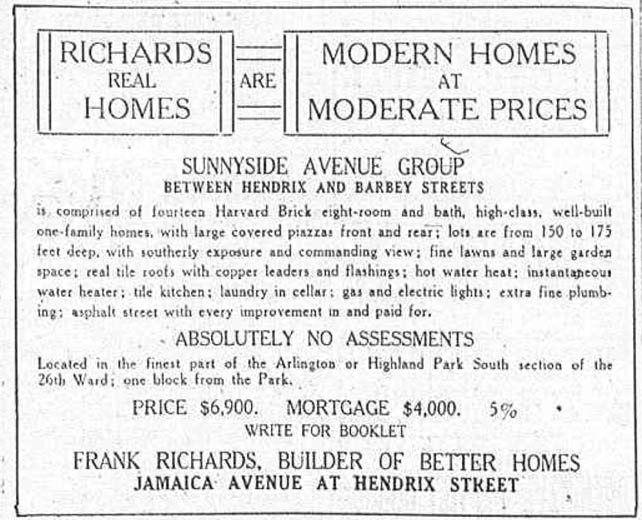
Schenck Court, East New York, Brooklyn Maker: Commercial Art Post Card Co. Dated: 1915 Status: Own(RG) On the right, a Brooklyn Daily Eagle advertisement for the homes Richards built on Sunnyside Avenue in 1913. | |

|
|
Sunnyside, 1923 These Armbruster images are of the east end of Sunnyside Avenue before the park. | |
|
Sunnyside Ave, 2005 My brother shot this picture of the Highland Park tennis courts and I noticed the house in the background is the same one in the 1923 photo (and can also be seen in the 2005 shot at the top of the Warwick Street entrance). | ||
|
|
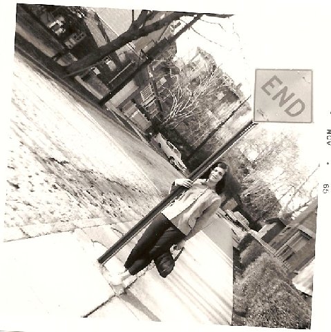
Barbey and Sunnyside, 1965 Sent in by Lucy (Patini) Ellis, the location is Barbey Street, north of Sunnyside Ave. Behind her friend Fran Fiorino the road curves sharply to the right, then north again,coming to a dead end at Highland Boulevard. The house up on Highland Boulevard in the background is still there, but is not visible in my update picture. | |
|
|
Barbey Court Neil supplied this 1939 tax photo and 2006 update shot of Barbey Court, on the north side of Jamaica Ave. | |
|
Barbey Court, 2006 Neil also took this shot of the end of Barbey Court; it sits a foot or two lower then Highland Boulevard. I did some research, checking the 1905 Plat maps and discovered in the original development plans Barbey was supposed to connect with Highland Boulevard, and Sunnyside was to connect to Warwick Street which was planned to run north across Jamaica and intersect. We know that never happened, but wonder if Barbey ever did connect with Highland Boulevard at some point. Our unoffical historian Mary Cornell does not believe there was ever a connection, she recalls there were steps here in this location and the concrete was probably just the footing for those stairs. | ||
|
|
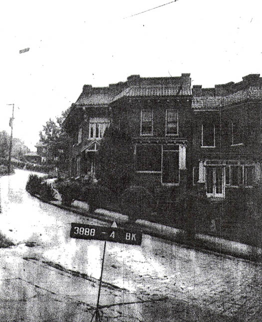
Sunnyside Ave, East New York Dated: 1920 Maker:Commercial Post Card Co. Status: Own(BG) Jacqui Ascenzi (Ruvolo) points out that the uphill homes are on the left, and thus this a view east towards the park. I believe it is west of Barbey. Neil Sullivan's 2006 shot is a view looking west from the park towards Sunnyside. As mentioned above, in early development plans this road was to extend into the park and meet Warwick Street. | |
|
|
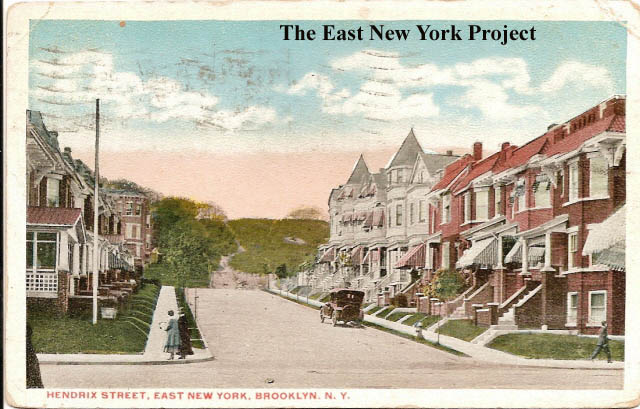
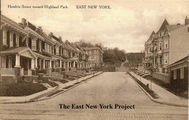
Hendrix Street, East New York, Brooklyn Maker: Commercial Art Post Card Co. Dated: 1917 Status:Need Hendrix Street toward Highland Park, East New York Maker: P. Miller Dated: 1913 Status:Own(BG) These shots are also posted on the Hendrix Street page with more details. More Richards Homes development north of Jamaica. | |
|
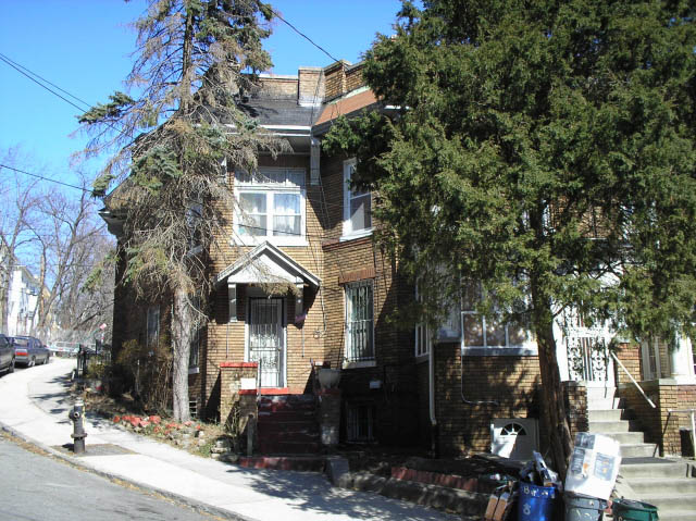
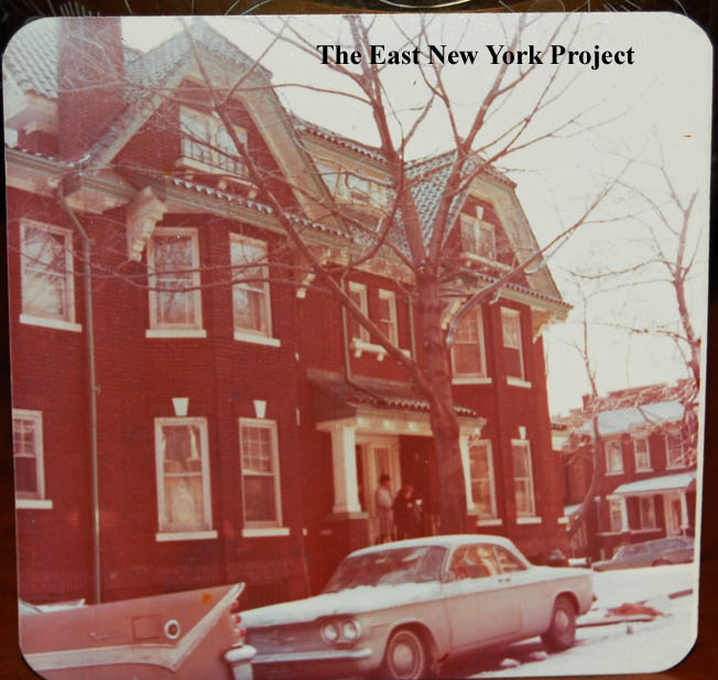
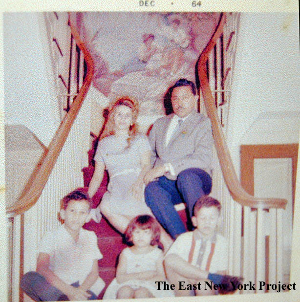
140 Sunnyside Avenue, 1960s 140 Sunnyside Avenue, on the southeast corner of Sunnyside and Hendrix, was first brought to our attention by Jacqui Ascenzi, who recalled the mansion-like house had a dumbwaiter. We have now heard from Fatima (Silvestre) Hawkins, whose family lived there in the 1950s and 1960s. Fatima sent this picture and confirmation; "Yes, its true about the "dumb waiter" my youngest brother would hide in it all the time and my parents would go crazy looking for him. The "dumb waiter" started at the top floor and ended in the basement of the house. Also, it did have a Grand Staircase with a beautiful Italian mural at the landing before the stairs would split. The flowerbeds at the front of the house today were made by my father." | ||
|
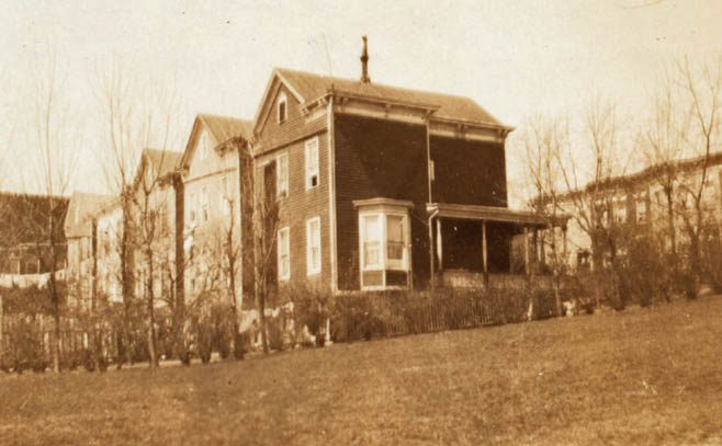
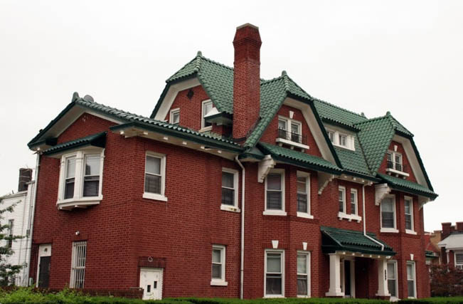
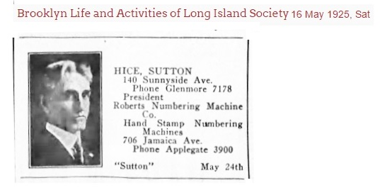
140 Sunnyside Avenue, today The house remains in great shape, as can be seen in a current photo. Fatima's email prompted me to research the property. I discovered the architect was William C. Winters of 106 Van Siclen Avenue. Winters was the same architect for all the Real Richards Homes that dominate the Sunnyside area, which is why the house fit in with that architecture. Of course those houses sold for $6,900 when this house cost an estimated $20,000 to build. It was constructed around 1917 for a Russell Thomas. Not much is known about Thomas; he appears at this address in the 1920 census, and he is listed as a broker, self-employed. The house is sold in 1921 to George Sutton Hice, President of the Roberts Numbering Company on Richmond Street and Jamaica Avenue. I don't believe Mr. Hice took the Jamaica trolley to work; he had a personal chauffeur. That same year the house is burglarized, despite the existence of a burglar alarm. Hice is still there at the 1930 census. Fatima's father, Evaristo Silvestre, owned a furniture comany in Manhattan and purchased the house in the 1950's, though we are not sure from who. Thanks to Anthony Messina for finding the image of Hice. | ||
|
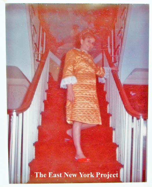
| 140 Sunnyside, interior Fatima was kind enough to supply some images of the stairway as well, including the mural that both Jacqui and she had mentioned. Fatima confirmed the house was configured to have servants. "yes, the home had a separate entrance which would be the door to the left before the backyard fence and garage, that door separated the main house... it has or had steps to go up to the main kitchen area or down to the basement area. In the basement area there was a full room for the housekeeper and a full bathroom. It also had a laundry room and kitchen where the housekeeper cooked and brought the food to the dining room on second floor..... My parents added one more room in the basement when we lived in the house, because they had the five of us and we had a live-in nanny and housekeeper." Thanks again to Fatima and her family for sharing the images and information. | |
|
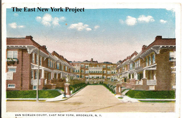
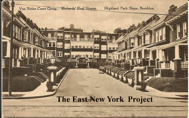
| Van Siclen Court Group Maker: Albertype Undated Status: Own(RG) Van Sicklen Court, East New York Maker: Art Post Card and Novelty Co. Dated: 1916 Status:Own (BG) This is north of Jamaica Ave.,with the second card showing the early spelling. Oddly, I had poor image of the first card taken from a different angle when I found this one. Note the victorian turret in the distance behind the homes. Note in the first card the reference to "Highland Park Slope". I suspect that was a marketing name at the time. | |
|
Van Siclen Court 2006 A 2006 update shot of Van Siclen Court. The building with the victorian turret is long gone, I don't believe it survived past the 1920s, replaced by the large apartment building. | ||
|
|
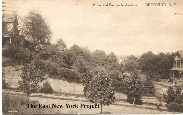
View From Highland Boulevard, East New York, Brooklyn Maker: P.Miller Dated: 1900 Status:Own(RG) Miller and Sunnyside Avenues Maker: Wm. Fick Dated: 1911 Status:Own(BG) Two more cards which can also be viewed in Zone 1, most of Sunnyside was part of Millers Orchards. The card on the right gives a rustic view of the area. The card on the left is marked with keys which help identify the view as Hendrix Street. Visit Zone 1 for the details. | |
|
|
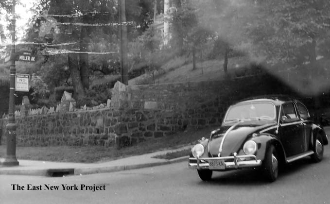
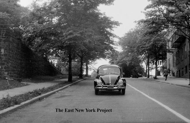
"Miller Hill" and Sunnyside Avenue, 1960s Thanks to Gloria (Profeta)Gallaway for supplying a classic (including a VW Beetle!) view of this location in the 1960s. In a precursor to "Jackass", I remember an old friend Philip DiGiore rolling a spare tire we had found down this hill on a dare, narrowly missing a bus on Jamaica Avenue.I also want to point out in the picture on the left the old 'humpback' street signs, which today are collectors items. | |
|
|
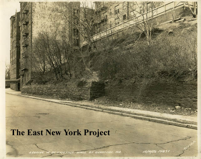
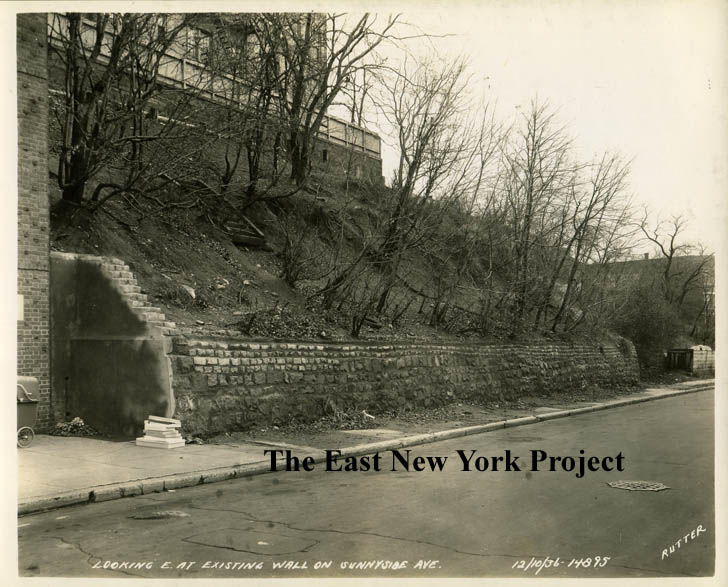
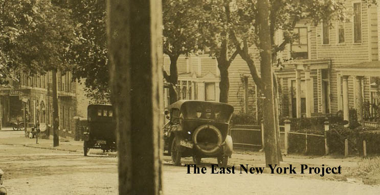
Sunnyside Avenue, 1936 From the Brian Merlis archives, these views are of the north side of Sunnyside Avenue just east of Miller Avenue. It's not clear why these were taken; Rutter usually documented infrastructure work for the city. The apartment building on the left at 79 Sunnyside Avenue was completed in 1930. Notice in the image on the right there appears to be a an old set of stairs behind the retaining wall; I assume they once led to a former residence in that location. | |
|
|
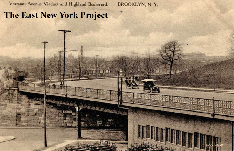
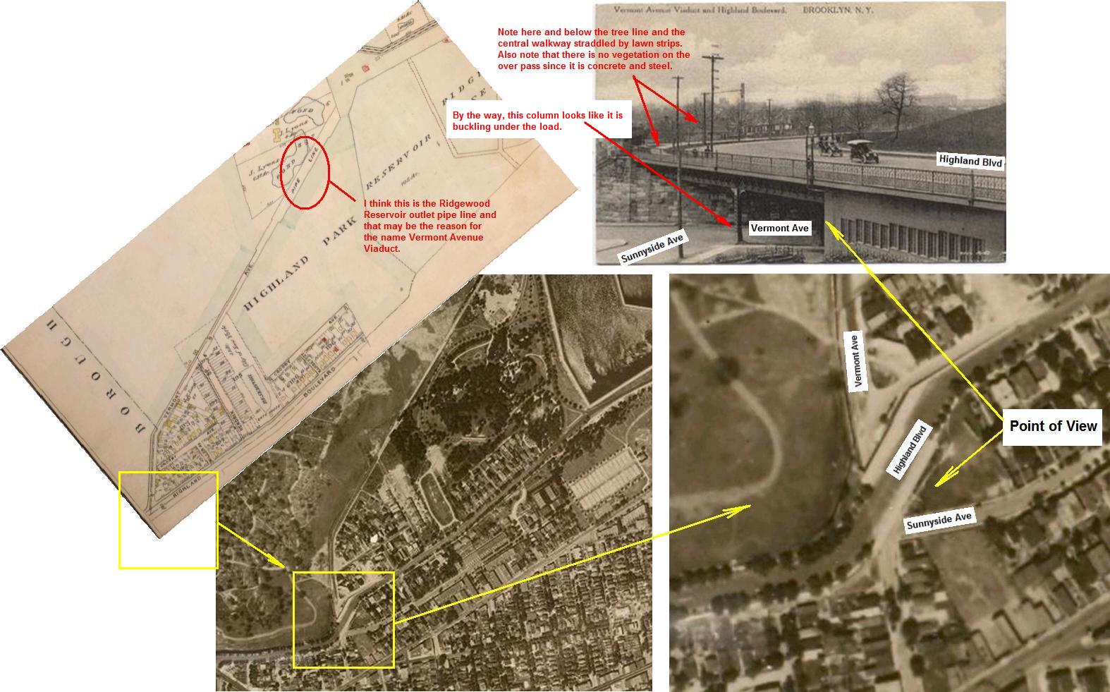
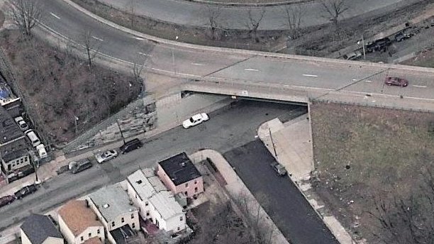
Vermont Ave Viaduct and Highland Boulevard Maker: Wm. Fick: dated 1910 Status: Need Anthony Messina helps pinpoint the location for us. The viaduct was constructed in 1895; planners had a vision of a boulevard connecting Prospect, Highland and Forest Parks. The viaduct was meant to bridge a connection between Eastern Parkway and Highland Boulevard, with Highland Boulevard being extended east. The eastern part of that project eventually morphed into the Interboro Parkway. | |
|
|
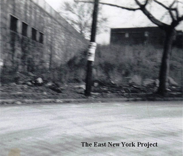
Vermont Ave Viaduct and Highland Boulevard I used Local Live to try to orient the image; some of the stonework on the original retaining wall still exists. At the bottom the square house on the corner is 5 Vermont Avenue, see below. On the right Cora (Gavin) Modica sent this shot of the Sunnyside/Vermont corner in the 1960s, though I'm not sure why the shot was taken. Al Gavin relays that Cora's mother Marion once told him the city used to have a storage area under the aqueduct and one legend is that parts of the Schenck house were stored there. It is all cemented up these days. | |
|
|
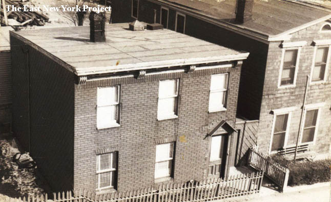
5 Vermont Ave,. 1950s Cora (Gavin) Modica sent in these shots taken of her home at 5 Vermont, from the aqueduct, in the 1950s. | |
|
|
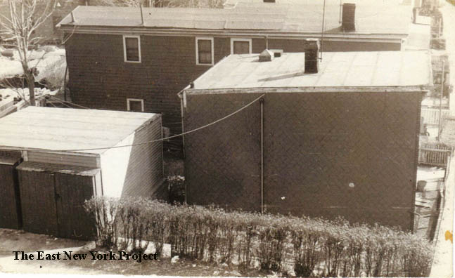
18 to 22 Vermont Street 1960s Richard Nowak told me he lived at 22 Vermont, and his mother grew up at 18 Vermont Street. His father did some amateur photography, and this great color shot is of 18,20, and 22 Vermont Street in the 1960s. "My mother told us stories of homemade wine kits exploding in the basement of 18 Vermont Street. Relatives on her mother's side (the Benzigers) made wine for the churches in New York. The descendants of the Benzigers later moved to California and established the Benziger Winery." Richard recently returned to the block and discovered a neighbor, the Planas family, still there. I dug into the archives and found a photo from the Brian Merlis collection looking down Vermont Street from Sunnyside Avenue in 1923. | |
|
|
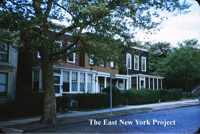
18 Vermont Street, Flag Day, 1954 Richard Nowak also sent this photo taken on June 14, 1954- Flag Day. Flag Day commemorates the recognition of our national flag on June 14, 1777. The view is across from 18 Vermont, so I added an update picture which shows those houses are still standing but the wooden porches are long gone. | |
| This 1913 New York Times article discusses real estate in Brooklyn and actually has a photo of some houses on Sunnyside.This is a 1.3mb pdf file that will launch when you click on it. | |||