        |
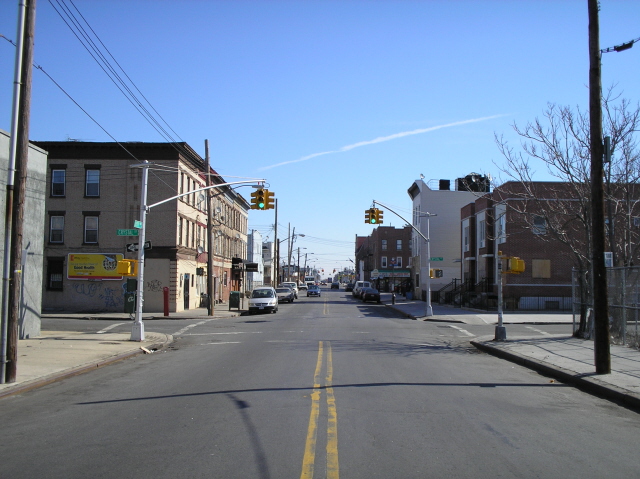
Liberty Avenue |
|||
|
|
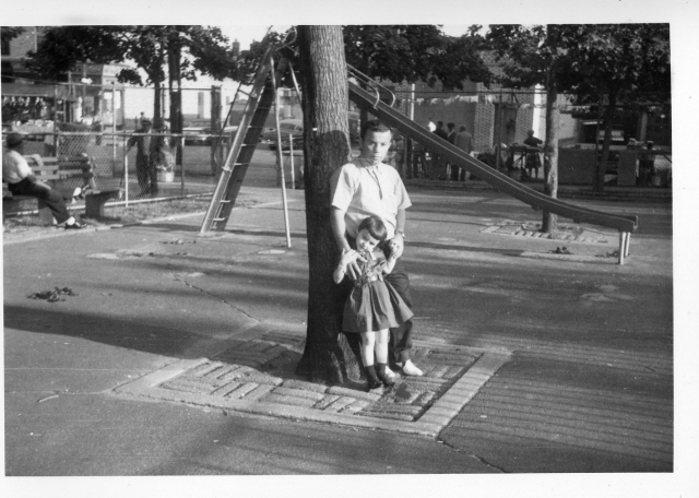
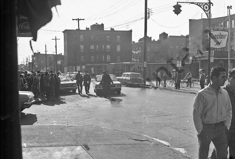
Liberty Playground The playground, known as the Elton St. Park to some and Liberty Park or playground to others, opened around 1939. We have received photos from Elsie Anzalone and Cynthia Rongione and there is now a page devoted to the park which can be found here. The shot on the left is from Cynthia in 1963 and Liberty runs along the background where there appear to be several vendors. On the right a view of the corner of Elton and Liberty in 1960. | |
|
|
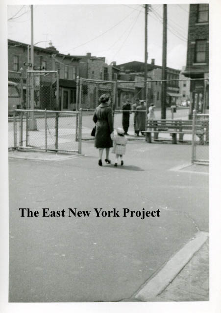
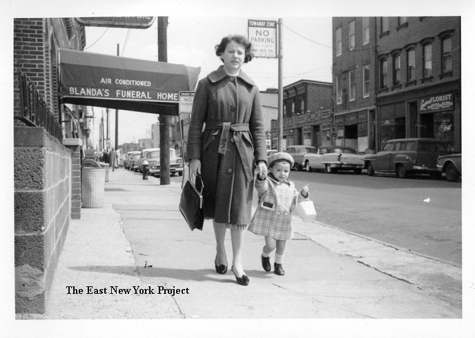
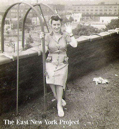
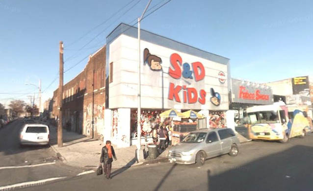
Also in 1960, the Amazin' Cin sent over this shot of her and her mother passing the Blanda Funeral Home. On the right, Mary Ann (LaNeve) Massey sent in this great shot taken in the 1940s of her mother on the roof of 724 Liberty Avenue. The picture was meant to show the playground in the back to her husband who was in the service overseas. | |
|
|
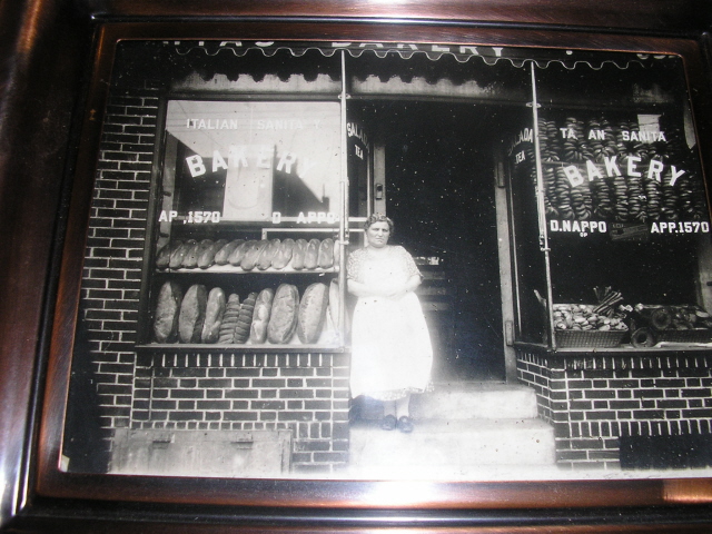
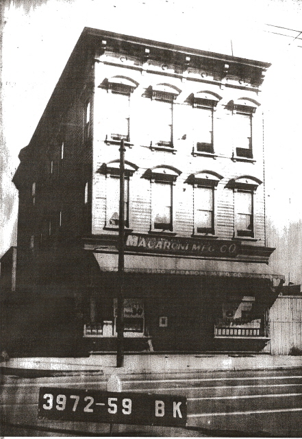
Nappo's Bakery, Macaroni Mfg. Co. Liberty Ave. was lined with Italian American establishments . Rose Hanley sends in this great pic of her grandparent's bakery at 682 Liberty, between Cleveland and Elton. That's her grandmother Rose Nappo in the picture. She notes that the Vesuvius Restaurant was down the street and the Russos had a Lattecina across from the bakery. While browsing the tax photos, I found this shot of the Macaroni Mfg. Co. at 743 Liberty, which was the northeast corner of Essex and Liberty. | |
|
|
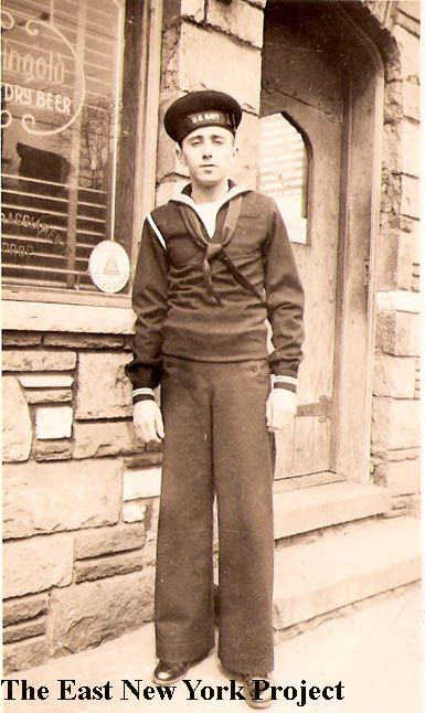
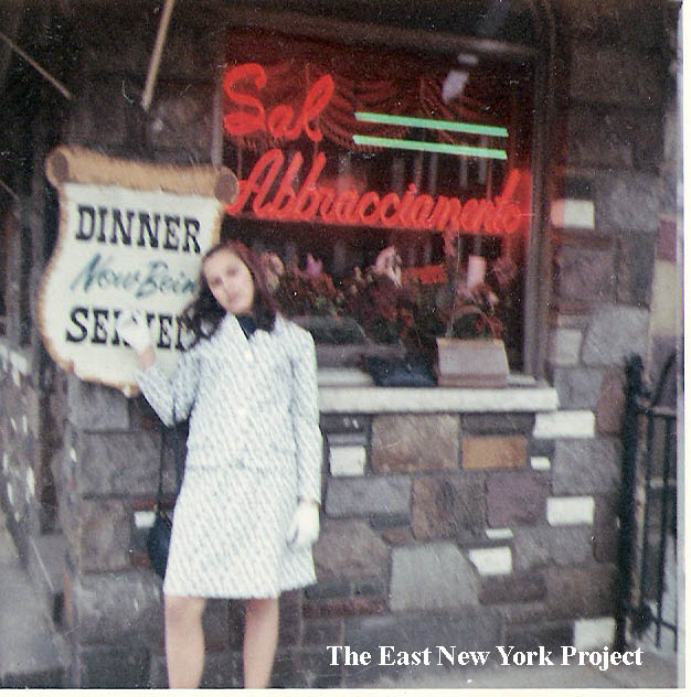
Abbracciamento's, Liberty Ave. Danny Blanda has been another great contributor to the site, and he sent over these shots of the long running restaurant; an early shot of his dad from 1943 and his sister Carrie from 1968. Louis Caracappa adds; "We used to go to Abbracaiamento� s also � ... The real story was the Body and Fender shop next door called Johnson�s. Mr. Johnson was an old African American gentleman who dealt only in cash. He was a friend of my uncle Tony Palazzo who kept his 1963 Chevy Bel Air in pristine condition. Johnson has 3 prices $150 for a dent or ping, $600 to repair like a dented fender, and $1500 if there was major damage. Cash only, no credit no checks and no insurance! Johnson was an alcoholic and always smelled of booze, but man could he fix a dent." | |
|
|
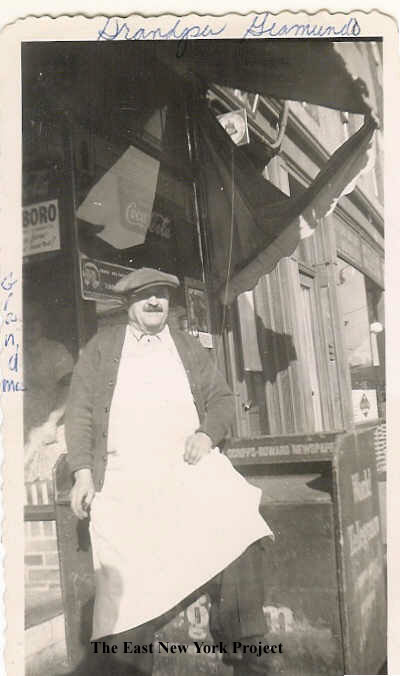
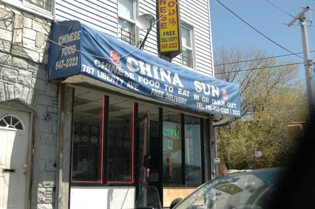
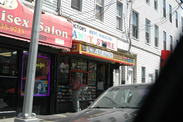
Zip's Candy Store I've seen several entries in the guestbook recalling Zip's candy store, and Mike Raffio, son of the former owner sends in these pics. On the first picture, from Mike "..the man is my grandfather, John Giamundo. If you look closely, my grandmother Ursula Giamundo is looking out the window. The store was 753 Liberty Ave. between Shepherd and Essex. My family lived above the store. My uncle was called "Zip" and he was always there so that's how the name came to be." | |
|
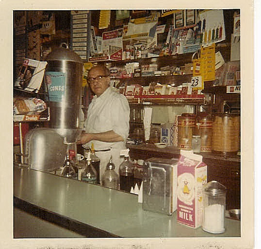
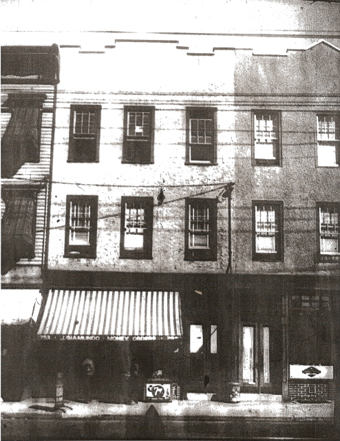
Zip's 1940 I found the tax photo, though the awning blocks out the store. Mike notes: "My family lived in the second floor apartment above the store at 753 Liberty Avenue. My Uncle Joe "Zip" lived in back of the store and my Uncle Dom and his family lived in the third floor apartment. The building to the left in the photo is 751 Liberty. Uncle Joe was a general contractor and his office was next to the store. We moved to the second floor of 751 and my Aunt Anna lived in the top floor apartment. The building to the right is 755 Liberty. My mother's cousins, DeGennaro, all lived there. (My cousin Donald DeGennaro has sent in some photos to the site of the feast at St. Rita's.) That's the way the old neighborhood was. Extended family all around." 
| ||
|
|
Thanks to Vinny Capasso for these update shots taken in December 2011. On the left the former Abbraciamento's, and on the right the former Zip's. | |
|
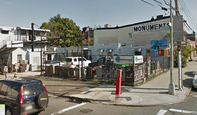 |
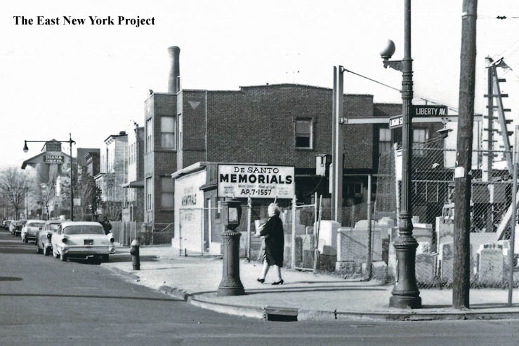
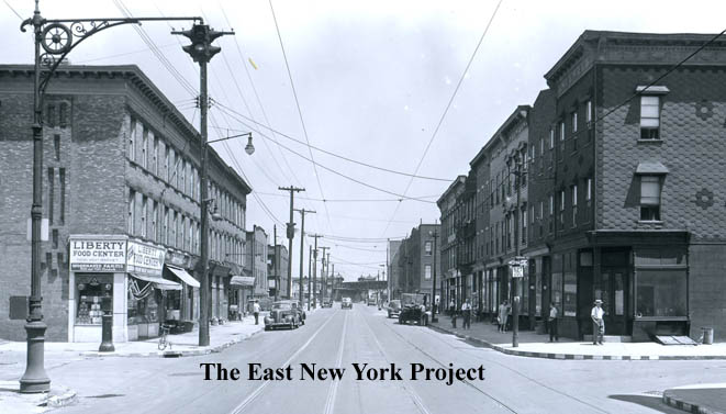
Northeast corner, Liberty and Logan We know the monument business on the northeast corner dates at least to the 1940s, and this shot from April of 1963 shows it when it was DeSanto monuments. It is still a monument business today, as seen on the right, Liberty Monuments. | 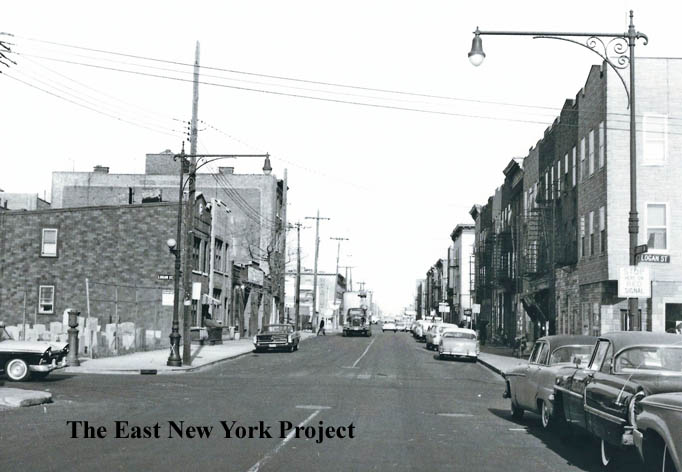
|
 |
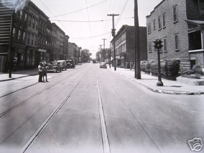
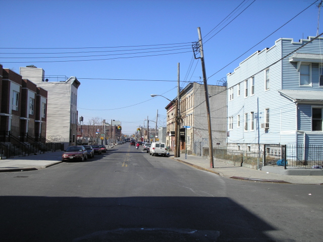
Liberty Avenue, east of Logan Also from April of 1963, the view is east along Logan. All the buildings on the right (south) side were cleared for a new condominium building around 2009. |
|
 |
Liberty Ave., west of Chestnut, 1943 and 2006. | |
 |
 |
Liberty Ave. east of Crystal, 1943 and 2006. Neil provided the update photos for these Liberty Ave. shots. | |
|
|
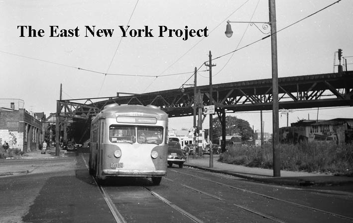
Liberty Avenue and Crystal Street, 1960s I'm stretching a little to place these with City Line, and I've been waiting for prints on this, which is why these have watermarks. These view are looking east along Liberty across Crystal. | |
|
|
Liberty Avenue and Crystal Street, 1960s The camera is pointed toward the north side of Liberty Avenue in the first shot; in the second we are looking west from Crystal Street. | |
|
 |
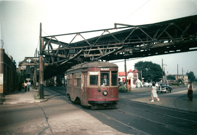
Liberty Ave., 1947 From the Brian Merlis Archives, a great 1947 color shot of the Bergen trolley on Liberty Avenue crossing Conduit Boulevard. On the right, buses began running in 1948. | |
|
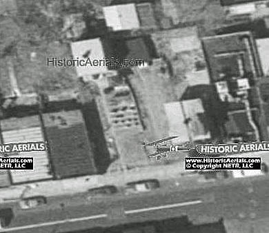 |
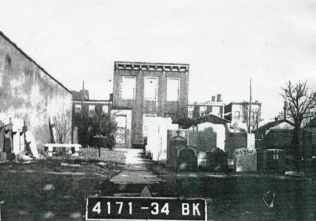
I stumbled on this going through tax photo microfilm. It looks like someone had a graveyard for a front lawn. The location is 1061 Liberty Avenue, just east of Crescent Street on the north side. I assume the owner was a granite carver or stone mason, the 1930 census listed a "paver" for a cement company and his family living there. This image is 11 years later, maybe there was a funeral home nearby. I used historicaerials.com to check on changes, and the aerial view is from 1980. It still looks like a monument business so maybe someone from our era remembers it. The building is now gone and the replacement comes up to the other buildings. | |
|
 |
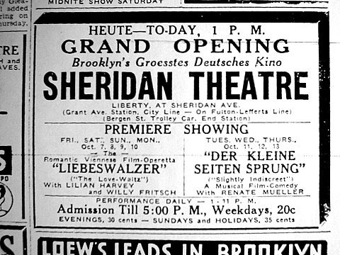
Sheridan Theater building, 1941 On the northeast corner of Sheridan and Liberty was the Sheridan Theater. Opened in 1915, it did not last long- it wasn't even a theater in the crummy 1941 tax image. The Cinema Treasures website provides some background- the Depression led the owners to try and save the theater by showing German and Austrian imports with English sub-titles, charging 35 cents. The policy failed, and the theater closed by 1933. | |
|
|
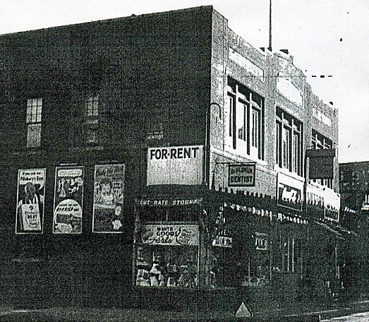
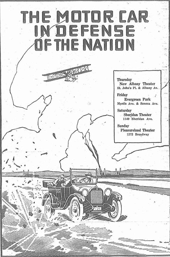
On the left, a 1917 Eagle ad for some sort of war support short. On the right,the building today, courtesy of Google maps. | |
|
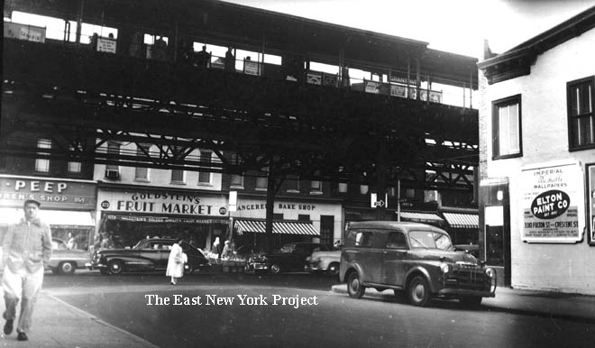
Liberty Ave., 1950 From the Brian Merlis Archives, the view is south toward Liberty Avenue from Grant around 1950. | ||
|
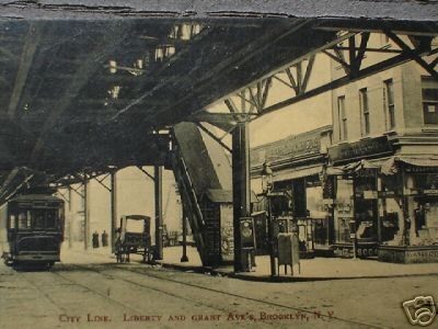 |
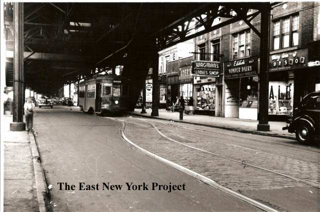
Liberty Ave., 1948 From the Brian Merlis Archives, this view is of the south side of Liberty Ave. between Grant and Sheridan in 1948. The Fulton el runs overhead at this time. City Line, Liberty and Grant Ave. Maker:Shinske Dated: 1910 Status: Need Rare photo postcard that went for $76 on Ebay. I assume it is the southeast corner but difficult to tell. | |
|
|
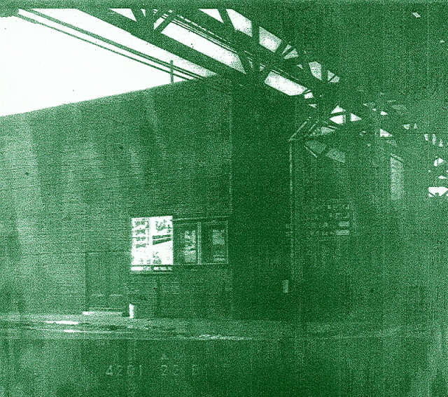
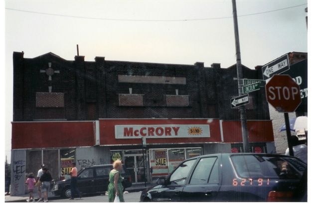
The Earl Theater I passed on this tax photo shot when I first found it, but Neil Sullivan was able to print a 'better' one if you can believe it. Located at Lincoln and Liberty, I always knew the theater as the Cityline Cinema. Liberty Avenue was once considered the "city line" at one time. Roberta "Cookie" Di maio remembers it as the Earl but also the nickname "The Itch". The Brooklyn Theater index indicates it opened as the City Line Theatre in 1921, on the Brandt circuit. It became the Earl in 1937. Vince Luongo contributed the 2005 view of the location. | |
|
|
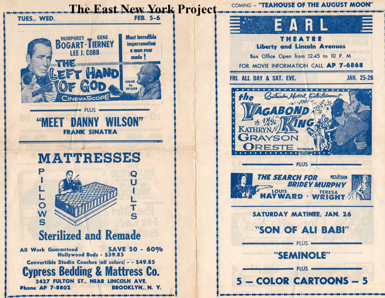
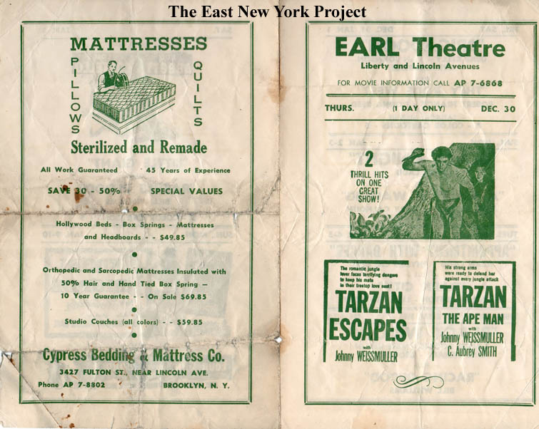
The Earl Theater playbills Two advertising playbills when it was know as the Earl; on the left is from 1956 and on the right from 1954. | |
|
|
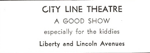
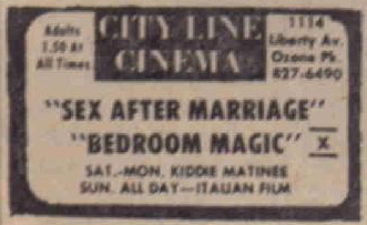
City Line ads 1935, 1973 It remains the Earl up to 1970, then re-opens in 1972 as the "City Line Cinema". It appeared to show X-rated fare during the week and B-movies on the weekend (see ad). I recall seeing "Across 110th Street" there in the 1970s. It closed sometime around 1980 and a clothing store took its place in 1982. | |
|
|
Liberty Ave. and Elderts Lane, 1940s This view is looking towards the southwest corner in the 1940s, matched with a current view. The El is of course gone but the buildings are still standing. | |