        |
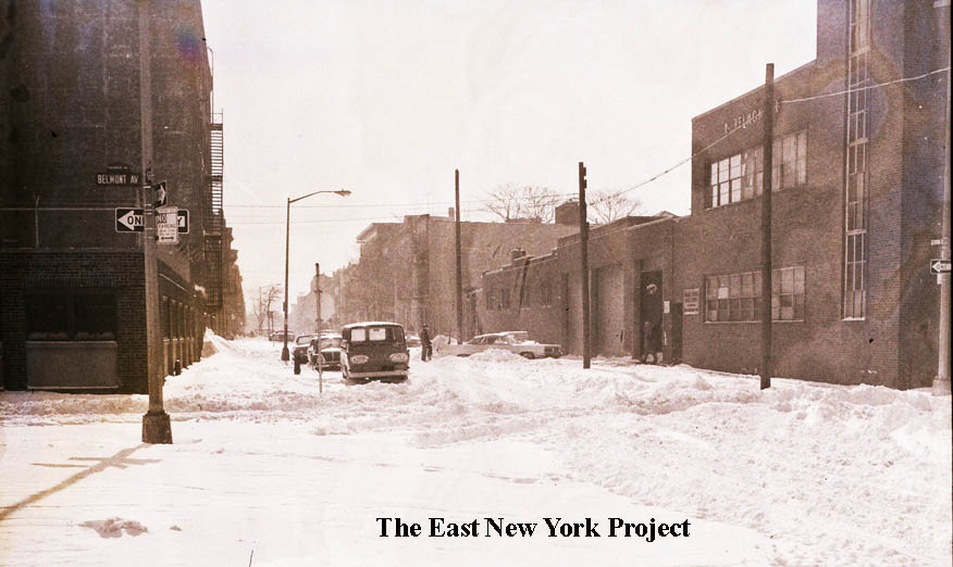
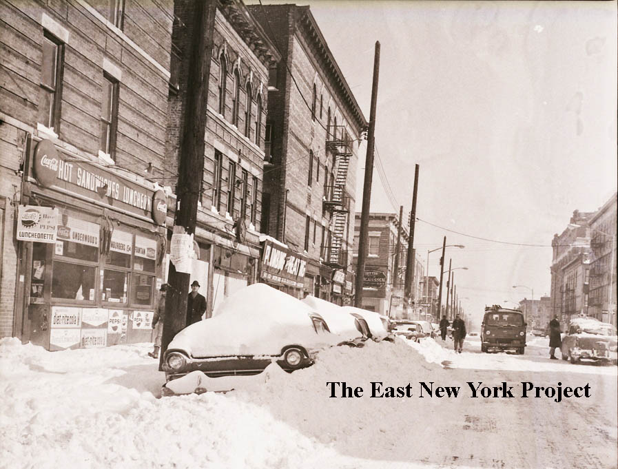
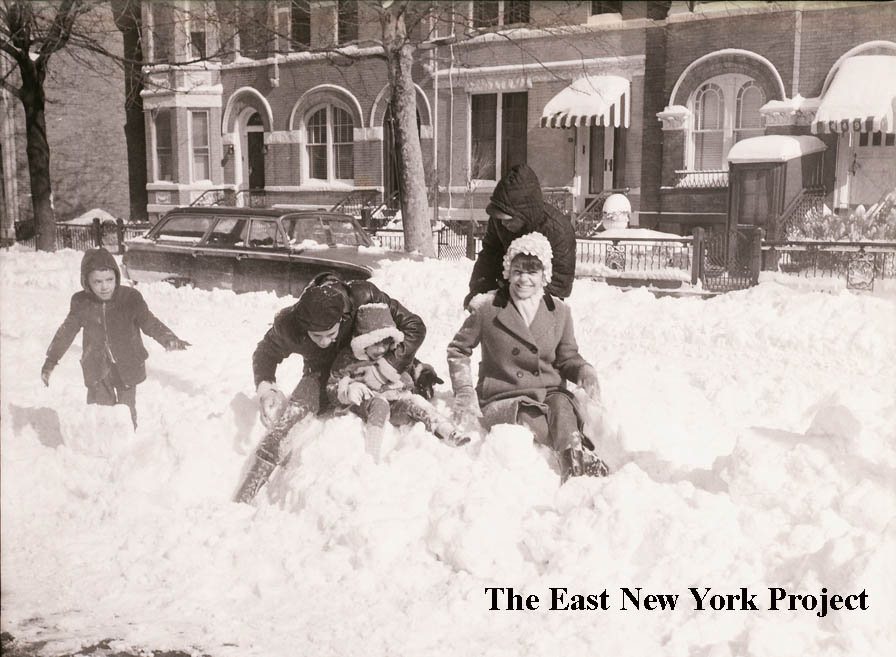
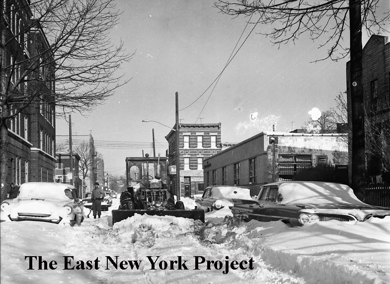
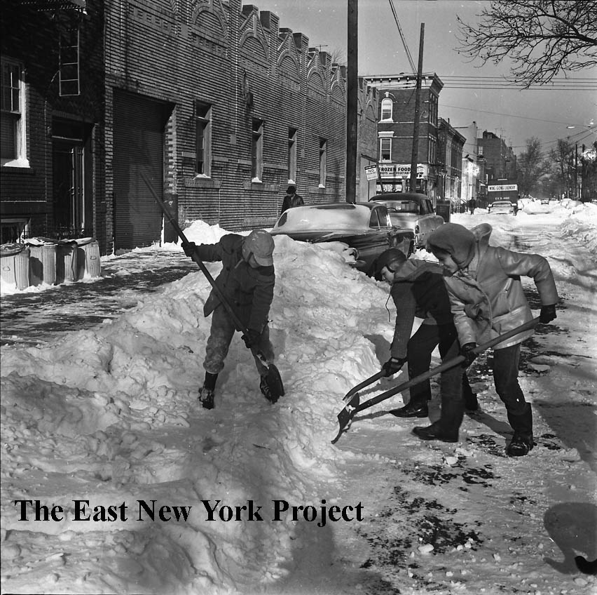
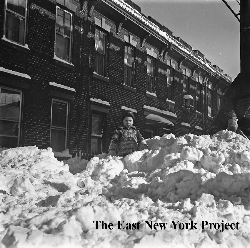
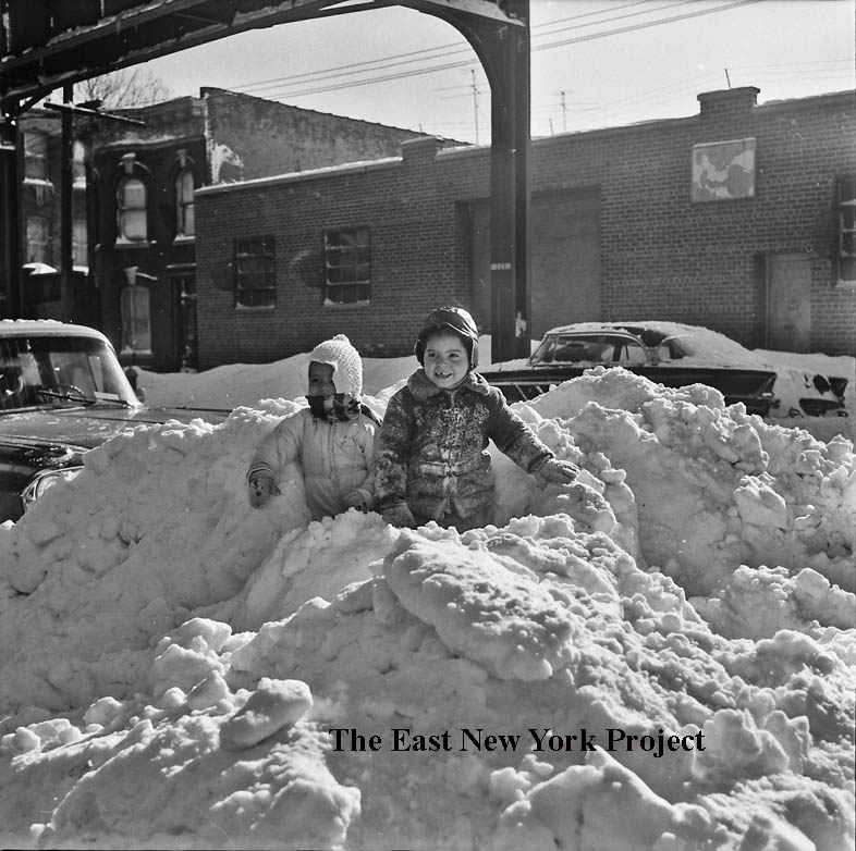
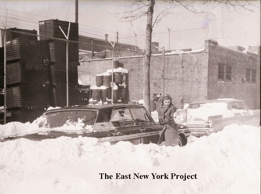
The 1960s - Part 2On February 7th of 1967, the city was hit with a blizzard. My mother noted in her diary, to some dismay, that the schools were shut for two days. Our freelancer covered a lot of ground moving around the neighborhood, catching the scene. Unlike the accident photos in Part 1, these locations were unidentified. I put in a lot of investigative effort to identify most of them, but there are few remaining that maybe someone can recognize. |
|||||||||||||||
|
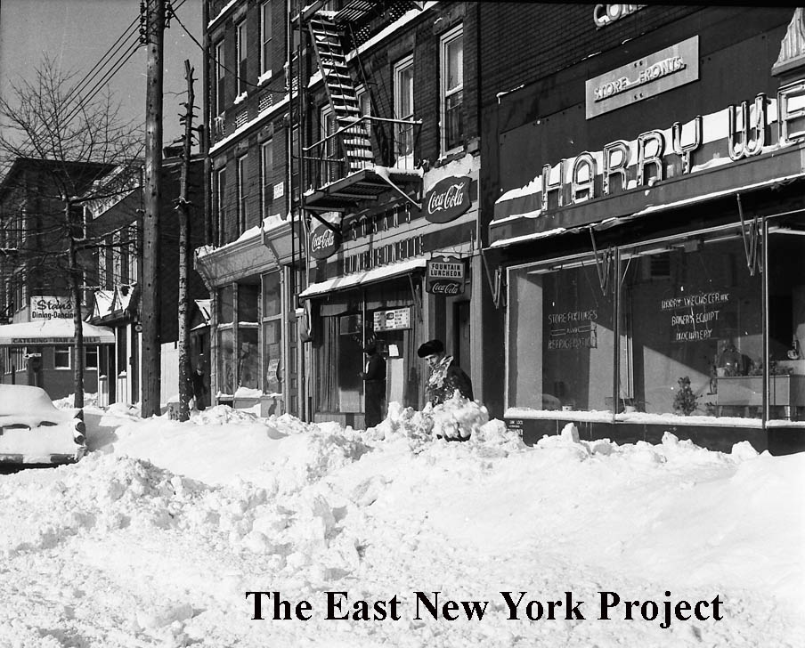
North side of Atlantic Avenue, looking west To Barbey Street On the far left I spotted Stan's; Tony Davenport had tipped me off years ago the owner was Stan Anania which helped me ID this photo. | ||||||||||||||
|
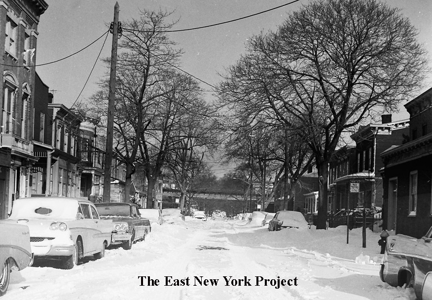
Barbey Street, looking north to Fulton Now we have moved to Barbey and turned toward Fulton Street. The el tipped me off we were looking toward Fulton Street, and that brick building on the left was the Barbey Street Republican Club, which I believe was demolished circa 1980. | ||||||||||||||
|
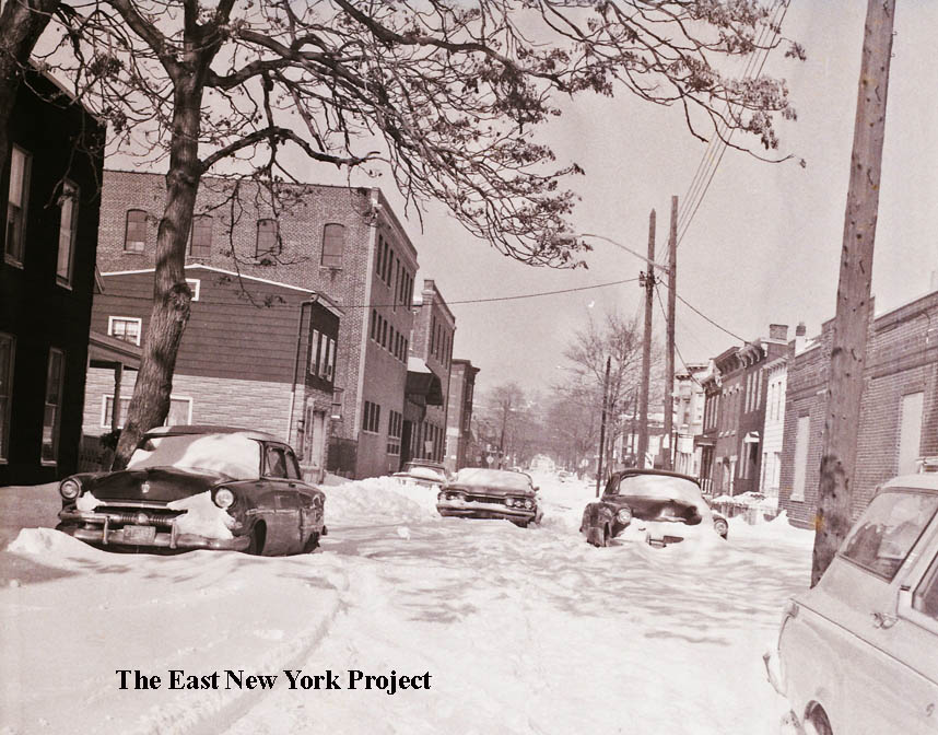
Barbey Street, looking north to Atlantic Avenue This one was a bit tougher. I could see the el on Fulton in the distance, so I knew we were facing north probably towards Atlantic Avenue. The building on the left was the key; it's the old Borden's Plant. | ||||||||||||||
|
|
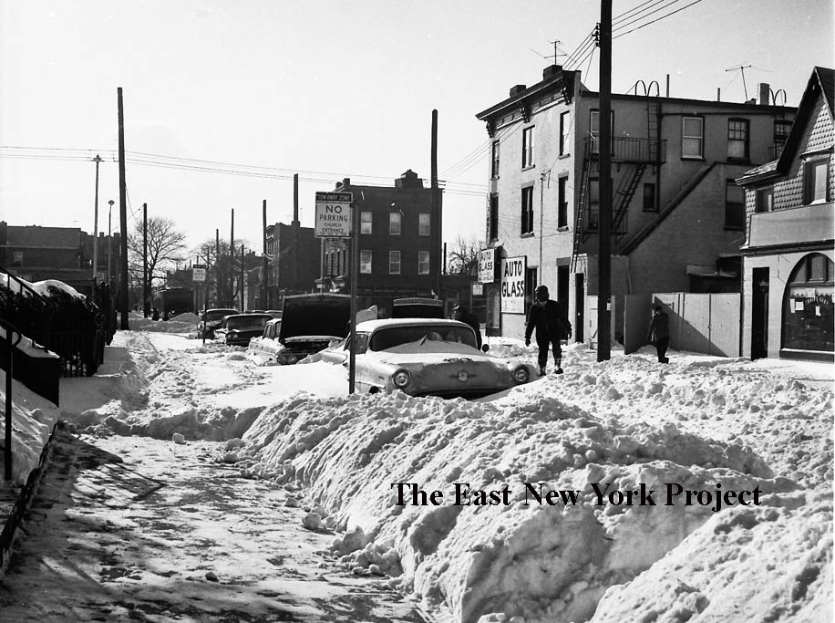
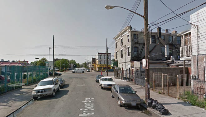
Van Siclen Avenue, looking south to Atlantic Avenue I recognized nothing in this photograph; the only key was the sign indicating no parking in front of the church. At first I disregarded St. Malachy's because that doesn't look like Atlantic Avenue, but in fact the building on the corner is still there to confirm the orientation. As we know the church is now gone. | |||||||||||||
|
Glenmore Avenue, east to Van Siclen Avenue, The street sign is visible and saved me, because nothing in this image is still standing. | ||||||||||||||
|
Glenmore Avenue, between Georigia and Alabama Avenues, This one is not 100% confirmed. We see a "3" poking out after the storefront, and my insurance maps confirmed a row of 3-story attached brick buildings on the north side, in the 300s. | ||||||||||||||
|
Glenmore Avenue, west to Williams Avenue This is the south side of Glenmore Avenue; 4-story buildings were rare on this stretch, helping me to identify them. | ||||||||||||||
|
|
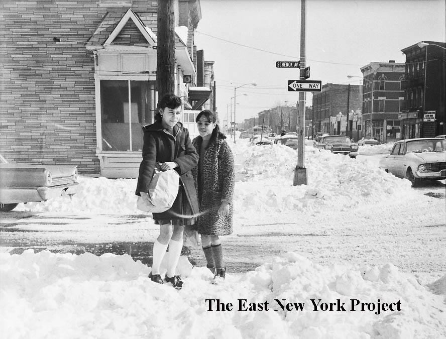
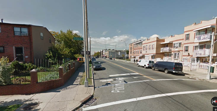
Schenck Avenue, looking east along Pitkin Avenue This one has a nice big street sign but I still had to consult insurance maps and Google maps to confirm the location. As you can see from the update shot, nothing is still standing but there's real improvement. | |||||||||||||
|
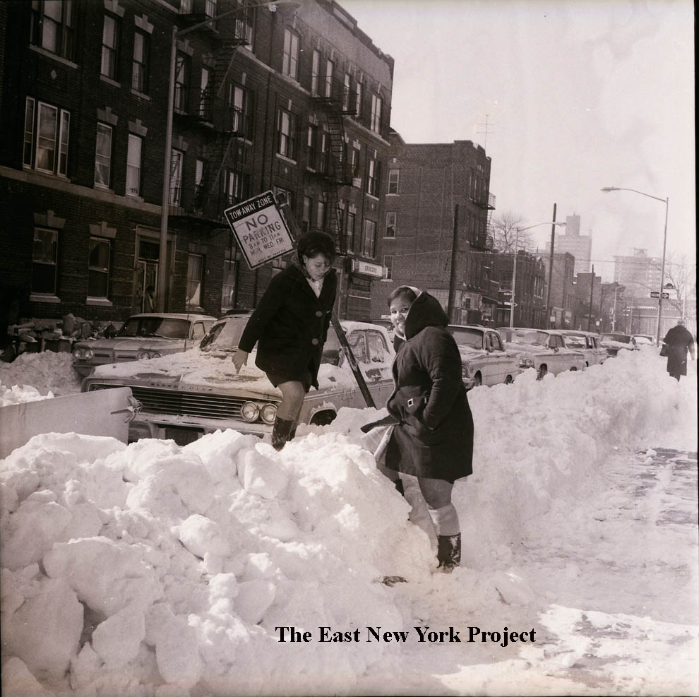
Pitkin Avenue, looking east to Barbey Street This one would have been impossible without the previous photo; the door overhang helped confirm we were looking at the north side of Pitkin past the girls in the first shot. | ||||||||||||||
|
Georgia Avenue, looking north from Belmont Avenue An easy one - the street sign is visible and Belmont Metals, still in business, is on the right. | ||||||||||||||
|
|
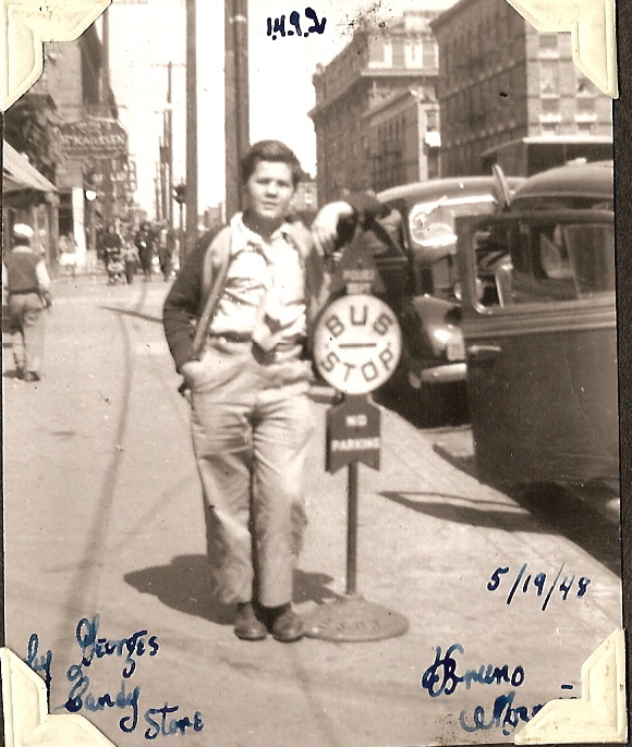
Sutter Avenue, looking east to New Jersey Avenue I recognized P.S. 149 in the distance, but this picture had an odd familiarity to me. Then I realized my mother took a picture from almost this same location back in 1948! (right) | |||||||||||||
|
|
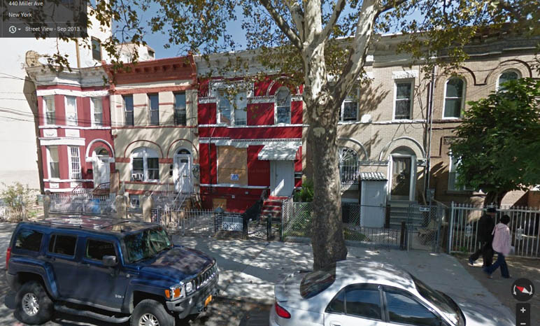
Miller Avenue, south of Sutter Avenue This one drove me crazy; the brickwork was unique, and I even had an address number, "449", to work with. But it took days poring over insurance maps to find possibilities, and I'm glad to say those nice buildings are still standing. It is the east side of Miller at the top of the block.
|
|
Hendrix Street, north to Sutter Avenue | The "indentation" on that 4-story apartment building was my clue, and helped me to spot and confirm the location on insurance maps. There is nothing in this image still standing.
|
|
825 Blake Avenue, between Schenck and Hendrix | I had to rely on Brian Merlis' extensive collection of old Brooklyn phonebooks to identify the merchant. Technically this is not 100% confirmed yet (the building is gone). |
|
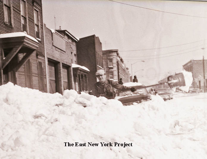
Blake Avenue, looking west to Van Siclen Avenue The bank at the end of the block - once a Manufacturers Hanover - was my clue. Today that is a church. | |||||
|
Schenck Avenue, looking north to Blake Avenue This one is unconfirmed. My suspicion is the one-story structure on the left was once the Blake Theater. It has the look of a small theater, but everything in this section is gone so more research is needed.Harold Moskowitz believes I have this one ID'd correctly; "I agree with your identification. The store on the northwest corner of Blake and Schenck was Taube's Superette in the late 1950's and early 1960's. I went to school with their daughter, Lena. The commercial building on the southwest corner during the same time frame, I believe was a plumbing supply company. I think it was called Blake Plumbing Supply. I remember delivery trucks backing up to the roll down gate delivery area and seeing piles of pipe etc. on the floor inside." | ||||||||||||||
|
|
Unidentified#1-SOLVED Harold Moskowitz came to the rescue and identified this as the northeast corner of Barbey and Livonia. Those houses are still there so confirmation was easy. | |||||||||||||
|
Unidentified#1b-SOLVED Harold Moskowitz also noted this view was the facing the opposite way, to the south of Livonia between Barbey and Jerome. Only the building to the far left (we are looking at the back of the building, it faces Jerome Street) is still standing. A huge apartment building occupies the site of the commercial building. Harold recalls;"The commercial building in the right side photo was some kind of fabrication operation built in the mid to late 1950's. The site had previously been occupied by a one family house with I think two adjacent lots on the northeast corner of New Lots Avenue and Barbey St. which were used for growing fruits and vegetables. I remember watching the owner wrap his fig tree for the coming winter. The lots extended from New Lots Ave. to Livonia Ave. If you look closely, you will see a grid like cage at the central part of each window to allow for the windows to pivot open during the work day. I remember climbing onto one of those grills in order to climb onto the roof to retrieve pink Spaulding balls that had landed on the roof during stickball and punchball games. " | ||||||||||||||
|
|
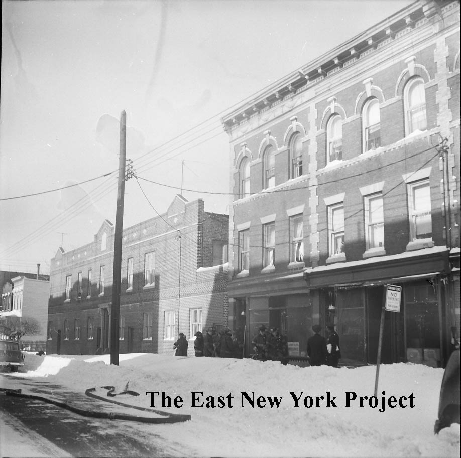
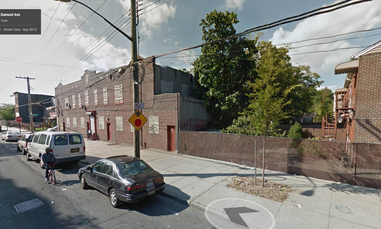
Unidentified#2-SOLVED I was fooled by what I thought was an elevated track on the far left, but Harold Moskowitz lived on the other side of the street from this shot and recognized it immediately. It is the north side of Dumont Avenue between Barbey and Jerome Streets. I've added a 2014 shot to show what is still standing. | |||||||||||||
|
|
Unidentified#3 Sandy Solano correctly ID'd this location - we are looking south along Bradford Street between Belmont and Sutter. | |||||||||||||
|
|
Unidentified#4 More amazingly, Sandy ID'd this one; it is Georgia Avenue, also between Belmont and Sutter. We are looking at the west side. | |||||||||||||